Table of Contents (click to expand)
Yes, Africa is slowly splitting in two. Along the East African Rift, the African plate is pulling apart into the Nubian and Somali plates at roughly 6-7 mm (about 0.25 in) per year. In 5 to 10 million years, this rifting could eventually open a new ocean basin, separating the Horn of Africa from the rest of the continent.
The global media began buzzing in 2018 when a large “crack” appeared in Kenya’s Rift Valley. Many scientists and geologists actively tried to get to the bottom of this strange and mysterious fissure, which seemed to have appeared out of nowhere. Some early reports leapt to a dramatic conclusion: that the African continent is splitting in two. With that frightening prospect in mind, let’s try to take a holistic view as to what actually took place concerning this “crack.”
The Incident
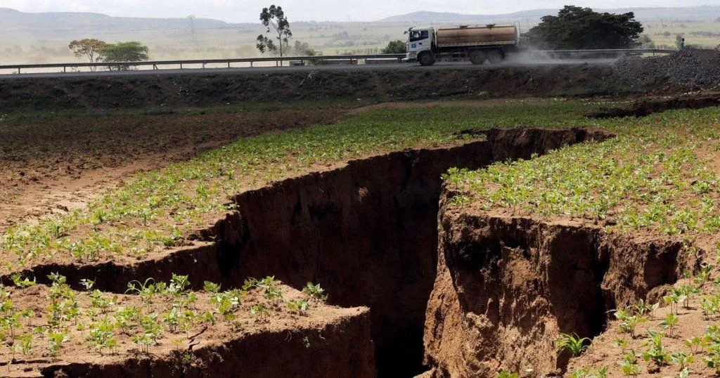
A large crack, stretching several kilometers (a couple of miles), suddenly appeared in March 2018 near Mai Mahiu in southwestern Kenya, west of Nairobi. The fissure tore open part of the Nairobi-Narok highway and kept growing over the following days. In those first chaotic reports, it was closely linked to tectonic activity along the East African Rift. After closer study, however, most geologists concluded that the crack is most likely an erosion gully, carved out when unusually heavy rainfall washed away the soft volcanic soils that had filled an older rift-related fault. Questions still linger as to exactly why the crack opened where it did, and whether it has any direct connection to the East African Rift, but on its own it is not the continent tearing apart.
Now, Earth as a whole is not a planet that experiences a constant state of homeostasis. Its changes occur on such a minute level that it can be very hard for us to observe. Plate tectonics is a classic example. The tectonic movement keeps happening on a minute level, but is only noticed when something major happens. Yet, every now and again, the tectonic plate shift becomes so dramatic that it leads to renewed questions about the African Continent splitting in two.
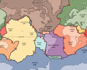
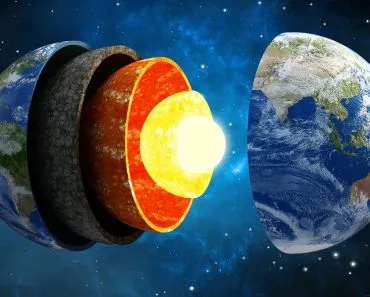
The Earth’s lithosphere (formed by the crust and the upper part of the mantle) is broken up into tectonic plates. These plates are not stationary, but instead move relative to each other at varying speeds, “gliding” over a viscous asthenosphere. Exactly what mechanism or mechanisms are behind their movement is still widely debated, but are likely to include convection currents within the asthenosphere and the forces generated at the boundaries between the plates. These forces do not simply move the plates around; they can also cause plates to rupture, forming rifts and potentially leading to the creation of new plate boundaries. The East African Rift system is an example of where this is currently happening.
The East African Rift Valley stretches over 3,000 km (roughly 1,900 mi) from the Gulf of Aden in the north towards Zimbabwe in the south, splitting the African plate into two unequal parts: the larger Nubian plate to the west and the smaller Somali plate to the east. GPS measurements show the two plates pulling apart at only about 6-7 mm (around 0.25 in) per year, slower than your fingernails grow, which is why we rarely notice it. Activity along the eastern branch of the rift, running through Ethiopia, Kenya and Tanzania, drew renewed attention when the large crack appeared in southwestern Kenya.
Where Exactly Is Africa Splitting?
Trace the split on a map and you do not get a single clean line, but a lopsided letter Y. Its three arms meet in the Afar region of northeastern Ethiopia, a triple junction where the Arabian, Nubian and Somali plates are all pulling away from one another. Two of the arms are already well advanced: the Red Sea, which opened as Arabia tore away from the rest of Africa, and the Gulf of Aden, which meets it at the junction. GPS measurements put the Red Sea spreading at roughly 14 mm (0.55 in) per year near its southern end, tapering to about 5.6 mm (0.22 in) per year further north. The third arm is the East African Rift itself, the one still cutting through the continent. In the Danakil Depression, the low-lying corner of Afar where Lake Karum sits 116 m (380 ft) below sea level, the crust has been thinned so much that NASA describes it as a place that will someday fill with water as a new ocean or great lake is born.

Heading south from Afar, the rift forks around Lake Victoria into two branches. The eastern branch (the Gregory Rift) runs through Ethiopia and Kenya and is the volcanic one: it includes the Main Ethiopian Rift, the Kenya Rift and the site of the 2018 crack near Mai Mahiu, while Erta Ale, a shield volcano with an active lava lake, sits at its Afar end. The western branch (the Albertine Rift) curves in an arc from Uganda down to Malawi. It has far less volcanism but plenty of earthquakes, and its faults have dropped the land so far that they hold the second-deepest lake on Earth. Lake Tanganyika reaches 1,470 m (4,820 ft), behind only Lake Baikal, and in December 2005 a magnitude 6.8 earthquake beneath the lake was felt in Nairobi, about 975 km (605 mi) away. The block between the two branches is not quite Nubian and not quite Somali, so geologists treat it as a separate microplate, the Victoria plate, with another, the Rovuma plate, further south.
The rift is also opening at very different speeds along its length. Near Afar, the plates separate at up to about 6 mm (0.24 in) per year, while towards the southern end the rate drops to almost nothing. The two branches are different ages, too: the eastern branch formed around the end of the Eocene and the start of the Oligocene, whereas the western branch only began to stretch at the start of the Miocene. So when people ask which part of Africa is breaking off, the answer is the land on the eastern side of the rift: the Horn of Africa and the Somali plate behind it. The Nubian plate, carrying the vast majority of the continent, is the part that stays put.
Causes For Rifting
Mantle Convection
There are many reasons for the rifting of tectonic plates. Ultimately, all tectonic forces on Earth are the result of mantle convection, and the extensional forces required for rifting are no exception. Mantle convection occurs due to the thermal expansion of mantle material upon heating. The expansion causes a reduction in density in comparison to the overlying fluid, and the resulting buoyant forces cause the material to move upwards. Once the fluid reaches the surface, it cools and becomes denser and sinks. Heating then occurs, and the process repeats itself to form what is known as convection cells. Mantle convection can explain rifting simply by placing continental rifts at the boundaries of convection cells. It is unlikely that all rifts are the direct result of mantle convection, as is impossible to derive a set of simple cells that are compatible with the geometry and locations of all modern rifts. Thus, other forces must also be at work.
Plumes
There is another phenomenon called plumes that may be to blame. Rifting can be caused when hot material from a mantle plume reaches the base of a continental plate and causes the overlying lithosphere to heat up. In addition to this, the upward movement of the plume against the base of the plate results in extensional forces, which can cause rifting.
Slab Pull And Ridge Push
There is also another phenomenon known as slab pull and ridge push. As a continental plate is subducted, the material in the subduction zone tends to pull the plate downward, creating a force known as slab pull. Material built up at spreading ridges tends to push the two plates away, creating a force known as ridge push. Slab pull and ridge push can cause rifting when two ends of a continent are subjected to these forces. If the continent contains a weak zone, these forces can be sufficient to cause a continental break-up. Subduction may also cause rifting when the lithosphere bends before subduction. The bending increases the curvature of the plate, which means that the surface radius of the plate must increase, putting the plate under extensional forces, which can result in rifting. Rifting may also be apparent in areas of thickened elevated continental crust, such as those that result from collisional orogeny (mountain building). In these cases, the weight of the material causes lateral spreading due to gravitational collapse, and because of the spreading, stretching and rifting that occur.
A Broad Timeline
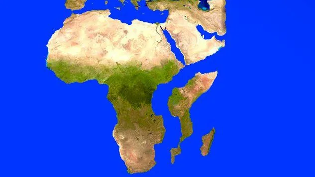
Rifts exhibit very distinctive topography, characterized by a series of fault-bounded depressions surrounded by higher terrain. In the East African system, a series of aligned rift valleys separated from each other by large bounding faults can be seen from space. Not all of these fractures formed at the same time, but rather followed a sequence starting in the Afar region in northern Ethiopia around 30m years ago and propagating southwards towards Zimbabwe at a mean rate of roughly 2.5-5 cm (about 1-2 in) per year. (This southward propagation of the rift is a separate, faster figure from the slow 6-7 mm per year at which the plates themselves are pulling apart today.)
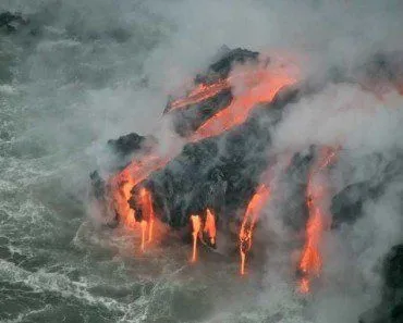
The East African Rift is unique in that it allows us to observe different stages of rifting along its length. To the south, where the rift is young, extension rates are low, and faulting occurs over a wide area. Volcanism and seismicity are limited. Towards the Afar region, however, the entire rift valley floor is covered with volcanic rocks. This suggests that, in this area, the lithosphere has thinned almost to the point of a complete break. When this happens, a new ocean will begin forming, fed by magma that solidifies in the space created by the separating plates. In fact, the Afar region has already given geologists a front-row seat: in 2005, a 60 km (37 mi) stretch of the Dabbahu rift segment tore open by as much as 8 m (26 ft) in just a few weeks as magma injected into the crust, the largest such rifting episode observed on land in the satellite era. Eventually, over the next 5 to 10 million years (with some estimates running to tens of millions), seafloor spreading should progress along the length of the rift. The ocean will flood in, the African continent will shrink, and a large new landmass will sit in the Indian Ocean, composed of parts of Ethiopia and Somalia, including the Horn of Africa.
Has Africa Split Before? How South America Broke Away
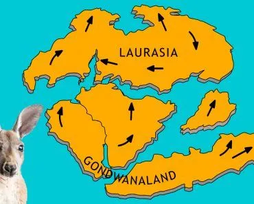
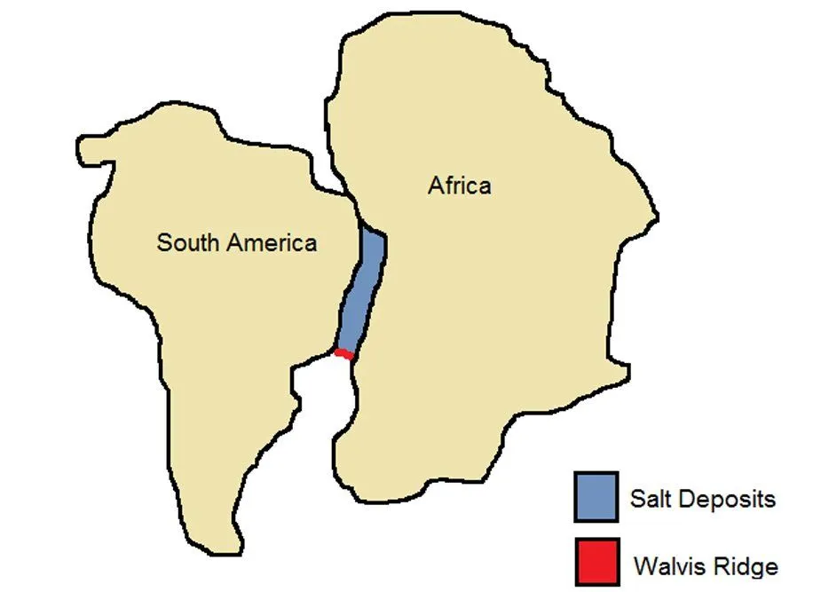
Yes, and the last time it happened, the result was the Atlantic Ocean. Look at a world map and the bulge of Brazil tucks neatly into the bight of West Africa. The German naturalist Alexander von Humboldt noticed this around 1800, and in 1912 Alfred Wegener built his theory of continental drift partly on that remarkable fit. Modern geology backs him up. A belt of ancient rocks along the Brazilian coast matches one in West Africa, and the same fossil species turn up on both shores: Mesosaurus, a freshwater reptile, and Cynognathus, a Triassic land reptile about 3 m (10 ft) long, are found in both South America and Africa, while the fern Glossopteris grew across all of the southern continents. The pattern only makes sense if those landmasses were once joined in the southern supercontinent Gondwana.

Gondwana was the southern half of Pangea, which began to break apart about 200 million years ago. The first oceans to open, some 180 million years ago, were the central Atlantic between northwestern Africa and North America, and the southwestern Indian Ocean between Africa and Antarctica. South America’s turn came about 140 million years ago. A reconstruction of the South Atlantic rift by Heine and colleagues, published in Solid Earth in 2013, found that the rift crept along at very low extension rates from about 140 to 126 million years ago, then sped up as the lithosphere rapidly weakened. The final break was not one event but a zipper running from south to north: the continents parted around 113 million years ago in the Santos-Benguela segment, off Brazil and Angola, and only around 103 million years ago in the equatorial Atlantic, between Ghana and northeastern Brazil. A 2023 study in Communications Earth & Environment found that seawater first flooded into the young rift basins from the south, roughly 121 million years ago. Rift, slow stretching, sudden weakening, a first trickle of seawater, then an ocean: it is the same script the East African Rift is now following. Today the Mid-Atlantic Ridge still pushes the two continents apart at an average of about 2.5 cm (1 in) per year.
Africa is not done drifting, either. The whole plate is pushing into southern Europe, and GPS studies put that convergence at only a few millimeters per year, comparable to the spreading across the East African Rift. Slow as that is, over the next 250 million years or so, it is expected to weld Africa and the Americas onto Eurasia in a supercontinent approaching Pangean proportions. The Somali plate may well break off along the way, but on the longest timescales, the continents are heading for a reunion.
References (click to expand)
- East African Rift System. Encyclopaedia Britannica
- What is tectonic shift? NOAA National Ocean Service
- Africa is splitting in two - here is why. The Conversation
- Features of plate tectonics. NOAA National Ocean Service
- Pangea. Encyclopaedia Britannica
- Continental drift. Encyclopaedia Britannica
- Historical perspective (This Dynamic Earth). U.S. Geological Survey
- Understanding plate motions (This Dynamic Earth). U.S. Geological Survey
- Map of East Africa showing historically active volcanoes and the Afar Triangle (This Dynamic Earth). U.S. Geological Survey
- Heine C, Zoethout J, Müller RD. Kinematics of the South Atlantic rift. Solid Earth (2013)
- Cui X, et al. Early Cretaceous marine incursions into South Atlantic rift basins originated from the south. Communications Earth & Environment (2023)
- McClusky S, et al. GPS constraints on Africa (Nubia) and Arabia plate motions. Geophysical Journal International (2003)
- East African Rift Valley, East Africa. The Geological Society of London
- Earthquake in Eastern Africa. NASA Earth Observatory
- Curiosities of the Danakil Depression. NASA Earth Observatory
- Tao W, Liang Q, Chen C. Density structures of the upper mantle in the East African Rift System. Frontiers in Earth Science (2024)