Table of Contents (click to expand)
Satellites help us catch fish by mapping ocean color and sea-surface temperature. Sensors like NASA’s MODIS and VIIRS measure chlorophyll, which makes phytoplankton-rich water look greener. Those blooms feed the food chain, so fish gather there. Paired with temperature fronts, the data steers fishing fleets toward the most productive fishing grounds.
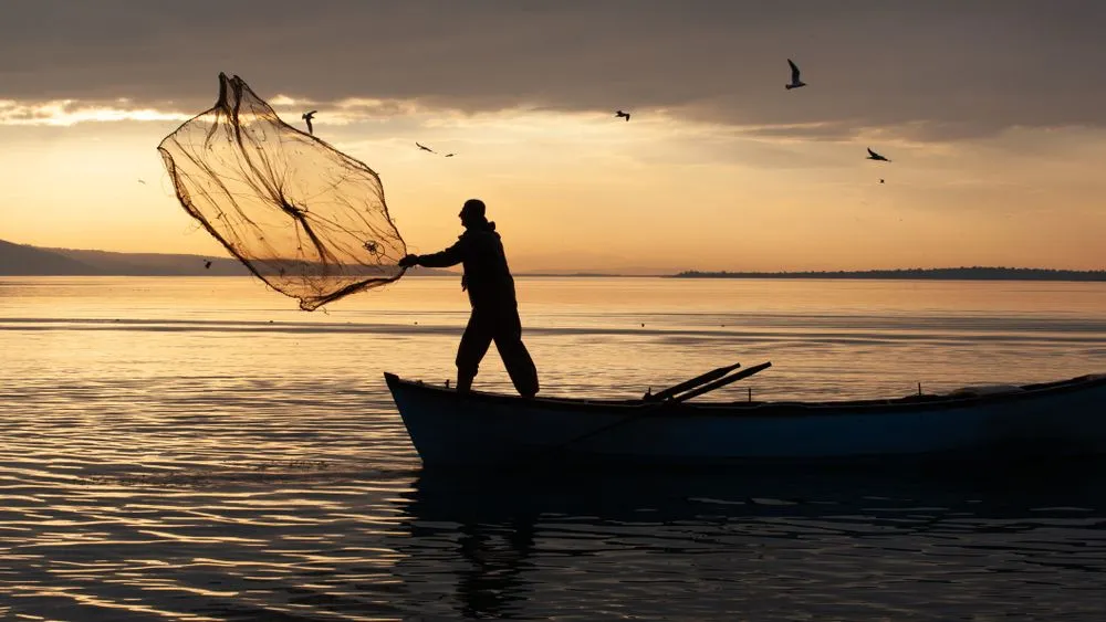
Imagine yourself on a boat in the middle of the ocean. The sun’s rays dazzle and shimmer on the water’s surface. You row your old boat to the fishing grounds and peer over the water to see sardines just below the surface, hoping to make your catch for the day.
Fishing has been a part of human life since before civilization was recorded. We slowly went from using hooks and spears and nets to using big boats to drag massive nets across the ocean floor. Over the years, the technology to catch fish has improved in many innovative ways.
But what do you think is the next step?
In this day and age, technology has advanced to the point where we can even find fish from space! This doesn’t mean that we can see fish underwater from space. To get a full understanding of how we find fish from space, we have to understand where fish go.
Moths To A Flame, Fish To Their Food
Fish, like all other animals, need food to live. Many people think of worms as “fish food”, but do you see worms floating around in the middle of the ocean? No! So what exactly do fish eat?
The first step to figuring out where a marine food chain starts is by comparing it to food chains on land. Now, you must be thinking, “Oh! the food chain on land starts with plants!” Indeed, that’s the same for food chains in the ocean.
The beginning of the food chain in any ecosystem is going to be a plant. They are called “primary producers” because they convert raw materials into food through the use of sunlight. Without them, animals would have no source of food and would not exist.
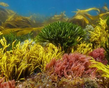
The primary producers of the ocean are algae. Some of them may be large and even look like plants on land, like kelp. However, more often than not, they are tiny and microscopic! All of these different types of algae are collectively called phytoplankton.
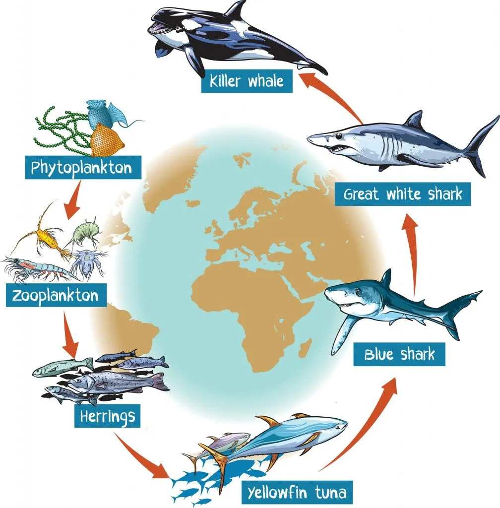
These “tiny plants” are eaten by animals that are almost as tiny! These tiny animals are called zooplankton. Now, slightly larger fish eat zooplankton. In turn, even larger fish eat those fish and the cycle goes on. The important thing is that the food chain starts with phytoplankton. The rest of the ecosystem is determined by where the phytoplankton are.
Now, unlike plants on land, phytoplankton won’t always be in the same location… so how do we find out where the phytoplankton are?
Searching For Plankton From Space
The location of phytoplankton is always going to keep changing. These tiny organisms are carried by the current from one place to the next and leave a trail of breadcrumbs, allowing the rest of the marine animals to follow them.
However, if it’s difficult to track fish using satellites, how would you be able to track microscopic plants? Well, the key lies in the word “plants”.
Plants are differentiated from animals because they make their own food through photosynthesis. To perform photosynthesis, they need chlorophyll. Phytoplankton, just like all other plants, need chlorophyll; it is this pigment that helps us search for these plants all the way from space.
Chlorophyll is a pigment that absorbs red and blue light, but reflects green. That’s exactly why most plants look green to you, and why a patch of ocean packed with phytoplankton shifts from deep blue to a murky green. Now, if there is a giant patch of phytoplankton in the ocean, two things will happen. Firstly, you will find large amounts of fish there, because that patch of phytoplankton essentially means more food for more fish. Secondly, a lot of red and blue light will be absorbed, and the water will reflect more green.
Satellites carry very specific and sensitive “ocean color” sensors. Instruments like NASA’s MODIS (aboard the Aqua and Terra satellites), VIIRS (aboard Suomi NPP and NOAA-20), and Europe’s Sentinel-3 OLCI measure how much blue, green, and red light bounces back off the sea surface. From that color signature, scientists estimate the concentration of chlorophyll-a, which works as a proxy for how much phytoplankton is floating there. Satellites can then pinpoint these places on a map.
The more chlorophyll the water holds, the greener it reads from orbit, and the higher the phytoplankton concentration. That means more fish would come to these areas, making them a better place for fishing than others.
Color isn’t the only clue, though. The same satellites also measure sea-surface temperature, and they reveal “fronts” where warm and cold water meet, along with upwelling zones where cold, nutrient-rich water rises from the deep. Those nutrients fuel phytoplankton blooms, so fronts and upwelling tend to be reliable fish magnets. By stacking chlorophyll maps and temperature data together, forecasters can flag the most promising fishing grounds days in advance.
A Final Word
Now, with the help of satellites, fishermen can find their fishing grounds with more ease. Most people would ask, “Won’t this harm ecosystems?” That would be true if fishermen owned their personal satellites to help them. Unless Jeff Bezos or Elon Musk decide to get on a boat and sail the seven seas, I think our oceans are safe from any space-based exploitation.
So, how exactly do satellites help fishermen and will our oceans be safe? Lucky for us, most of these Earth-observing satellites are government owned, often built and run through public partnerships. This means that the raw data on where the fish are likely to be is largely free and open to the public.
This kind of forecasting is now used by coastal nations around the world. In the United States, NOAA’s CoastWatch program turns sensors like MODIS, VIIRS, and Sentinel-3 OLCI into near-real-time chlorophyll and sea-surface temperature charts that fisheries and anglers rely on, while the UK, Australia, Canada, and the European Union tap the same Copernicus and NASA feeds. The result is a two-way collaboration: governments share the satellite data, and fishers use it to work smarter while managers keep an eye on the health of the stocks.
References (click to expand)
- NOAA CoastWatch Program. National Oceanic and Atmospheric Administration.
- Satellite Oceanography for Fisheries Management. NOAA Fisheries.
- What are Phytoplankton? NASA Earth Observatory.
- 3 ways satellites connect scientists with ocean life - NOAA. The National Oceanic and Atmospheric Administration
- Elements of Marine Ecology - 5th Edition - Elsevier. Elsevier
- EA Engel. Satellite Remote Sensing of Chlorophyll: Significance of PAR .... The University of Washington