Scientists track birds using leg bands, satellite and GPS tags, tiny light-recording geolocators, and automated radio-telemetry networks like Motus. Geolocators use day length and the timing of solar noon to estimate a bird’s position, while newer systems beam tag data to satellites, letting researchers map entire migrations without ever recapturing the bird.
For thousands of years, people wondered where birds went for certain parts of the year. There were many theories that tried to explain their apparent disappearance into thin air, including death by the wrath of God, or even ascension into heaven!
Certain people in medieval times also believed that some species were stuck in frozen lakes and could only come out once the lake thawed. There are records of people claiming that the birds went to the moon. We now know that these theories are false, but the true information was very difficult to acquire.

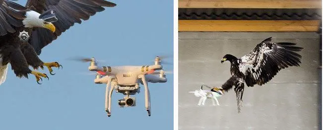
These ‘disappearing’ birds generally migrate to other parts of the world in order to escape harsh weather and mate with others in their species. However, the place where these birds went was a mystery to scientists. It’s not like they could follow these birds to their destination or even send out a drone to fly alongside them and thoroughly invade their privacy.
A Simple And Old Method To Track Birds’ Migration
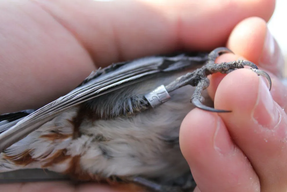
In 1899, a Danish schoolteacher named Hans Christian Cornelius Mortensen had an idea. He attached lightweight aluminum rings, each stamped with a unique number, to the legs of starlings and then released them back into their daily lives. When these birds were recaptured or sighted, their location would get recorded, giving people some clue as to their migration trajectory.
The first hard proof of long-distance migration came a few years later. A White Stork wearing a Hungarian ring, fitted as a chick in 1908, was shot in Natal, South Africa in January 1909. It was the first scientific evidence of a bird crossing the equator, settling once and for all that European storks really do fly to Africa. Still, the technique of banding birds is pretty rudimentary, as it tells researchers only some of the places a bird has been and not the whole path it traversed.
Fortunately, the tagged birds were declared to be ‘fashion icons’ by their fellow birds and now lead flamboyant and luxurious lifestyles. True story.
Transmitter Tied To The Bird’s Body
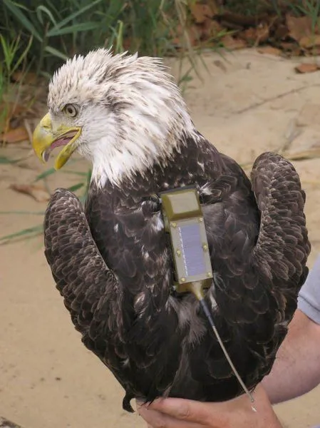
This problem seemed to have been resolved in the 1980s, when researchers in the USA began fitting large birds like the Bald Eagle with transmitters that relayed their location to satellites orbiting the Earth. These tags piggybacked on the Argos system, a satellite network launched in 1978 that pinpoints a transmitter by measuring the Doppler shift in its radio signal.
The reason why the Americans used a Bald Eagle is quite self-explanatory in itself, but the fact that these birds are big enough to fly even with the added weight of the transmitter certainly helped. As you might realize, the transmitters were pretty heavy with a very short battery life, thus disqualifying their use on smaller birds.
Migration Tracking System
GPS devices were much smaller because they receive signals from satellites, rather than transmitting them. This allowed for the use of GPS on small birds, like doves, but they were still quite heavy for songbirds. If the birds couldn’t even fly, there was no point in observing their ‘flight’ patterns.
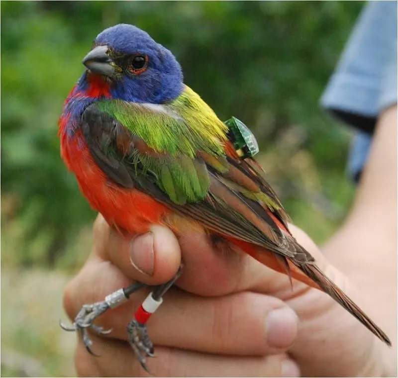
It took some time for researchers to have their next breakthrough, when they realized that they didn’t need to use satellites at all! Instead, they fitted the birds with a tiny sunlight intensity recorder. This recorder had a built-in clock and a memory chip to store the information.
This ‘migration tracking system’ ultimately weighed less than a gram, which meant that even small songbirds could easily fly with it. How these recorders are used to understand migration is similar to ancient navigational techniques.
The intensity of sunlight changes with respect to the time of day, as well as location. The length of each day is an indicator of latitude, while the time halfway between sunrise and sunset (noon) is indicative of the longitude. The clock in the recorder would measure the duration of a day, while the light intensity recorder would calculate the ‘time’ of noon at a particular location.
This data could be used to interpolate an approximate longitude and latitude; using this, we could track the complete trajectory of a migrating bird.
Tracking Birds From Radio Towers And Space
Geolocators have one annoying catch: you have to recapture the same bird to read the data off the chip. For a creature that flies between continents, those odds are not exactly comforting. So researchers built ways to collect the data without ever seeing the bird again.
One of these is the Motus Wildlife Tracking System, a network run by Birds Canada. The idea is delightfully simple: a bird wears a tiny radio tag that constantly chirps out its own ID code, and automated towers scattered across the landscape quietly listen for it. Whenever a tagged bird passes within range of a tower (roughly 15 kilometers, or about 9 miles), its visit is logged automatically and uploaded to a shared database. With well over a thousand receiving stations now spread across more than 30 countries, the network is light enough to put even tiny songbirds and bats on the map, no recapture required.
The most ambitious approach skips the towers altogether and listens from orbit. The ICARUS Initiative, led by Martin Wikelski at the Max Planck Institute of Animal Behavior, fits animals with miniature solar-powered tags that beam their data up to a receiver in space. A first version ran on the International Space Station from 2020, but the project was paused in 2022 after its collaboration with Russia ended. The team used the downtime to shrink the whole system onto a tiny CubeSat, which launched aboard a SpaceX rocket in November 2025 to give ICARUS, for the first time, truly global coverage.
What Do We Learn By Tracking Birds’ Migration Patterns?
These recorders (or, more appropriately, ‘Geo-locators’) have helped researchers understand bird species better than ever before. For example, the Arctic Tern is credited with having the longest migration on Earth. It was believed that it completed a trip of 40,000 kilometers between the Arctic and Antarctic every year.
However, more recent findings using Geo-locators revealed that these birds actually cover almost twice that distance every year. A landmark 2010 study that fitted Arctic Terns with 1.4-gram geolocators found an average annual round trip of about 70,900 kilometers (44,000 miles), with the busiest individuals clocking over 81,000 kilometers (50,000 miles). Scientists think they take these winding routes to ride the prevailing winds and thus reduce strain during their long journeys.
Anyway, over a lifespan that can top 30 years, that adds up to roughly 2.4 million kilometers (1.5 million miles) in a single bird, which is about the same as taking three round trips to the moon!

The exact nature of migration goes a long way towards understanding animal behavior. Researchers not only look at the animals’ migration pattern, but also what is between Point A and Point B to determine if a species is moving to new locations based on food density, changes in water temperature, or the animal’s ability to adapt to these changes.
If you are interested in how a bird decides where it needs to migrate, you might want to read this article here. Additionally, if you’re wondering why dogs don’t migrate, it’s because their time is better spent wondering who’s a good boy.
References (click to expand)
- Egevang et al. Tracking of Arctic terns (Sterna paradisaea) reveals longest animal migration. PNAS (PMC, NCBI)
- What Are Light-level Geolocators? Smithsonian's National Zoo and Conservation Biology Institute
- What is Satellite Telemetry? Smithsonian's National Zoo and Conservation Biology Institute
- Motus Wildlife Tracking System. Birds Canada
- Icarus returns to space. Max-Planck-Gesellschaft
- Arctic tern. Wikipedia (supplementary)