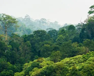
Geographers group landforms by the agent that shaped them. The main types are fluvial (rivers: waterfalls, V-shaped valleys, deltas), glacial (ice: cirques, fjords, moraines, outwash plains), aeolian (wind: sand dunes, mushroom rocks, loess plains), karst (dissolving limestone: caves, sinkholes, pillars), marine/coastal (waves and tides: cliffs, beaches, sea arches), and tectonic/volcanic (Earth's internal forces: mountains, rift valleys, calderas).
From the far-flung sea at a beach to the highest rise of peaks in a mountain range, landforms strike us with awe every time we begin to notice them!
A landform is a reflection of geological structure, sculpting processes, and time. Geologically speaking, it is the resultant impact of differences between endogenetic and exogenetic forces.
Endogenetic forces develop inside the earth, whereas exogenetic forces are the factors that affect the formation of a particular landform externally.
Three of the most widely studied categories are fluvial, glacial, and aeolian landforms, each named for the agent (water, ice, and wind) that sculpts it. As we will see, though, these are only part of the story: shifting tectonic plates, volcanoes, dissolving limestone, and the restless sea all leave their own signatures on the land.
What Are Fluvial Landforms?
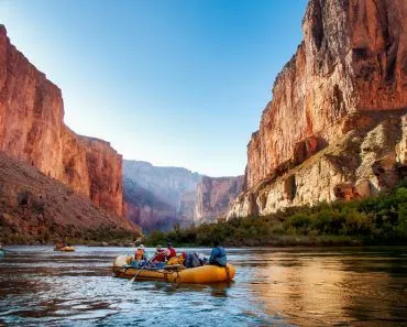
Landforms developed by a river are called fluvial landforms. You may not be surprised, therefore, to learn that waterfalls are also a type of fluvial landform. This is because when a fast-moving river flows over a cliff, it gives rise to a waterfall.
Moreover, if there is a series of waterfalls stationed one after the other, it results in the formation of a cascade. A cascade also belongs to this category of landforms!
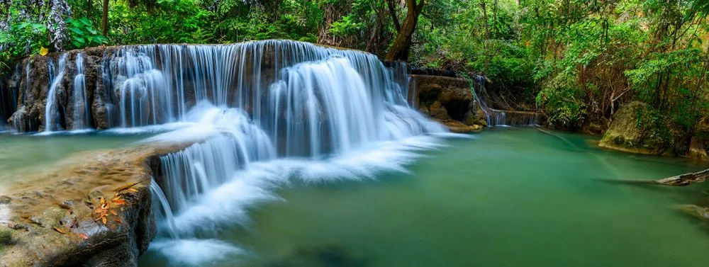
Not only that, but V-shaped valleys and gorges are also classic examples of fluvial landforms. A V-shaped valley forms when a river cuts downward faster than its sides can weather away, so the river chisels a deep channel while gravity and frost gradually slough the walls back into a "V" cross-section. Another widespread type of fluvial landform is the delta: when a river meets a slower body of water (a sea, a lake) and dumps its sediment load at the mouth, the sediment piles up into a fan- or arrowhead-shaped landmass, as with the Mississippi delta or the Nile delta.
What Are Glacial Landforms?
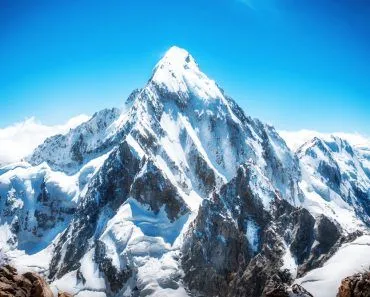
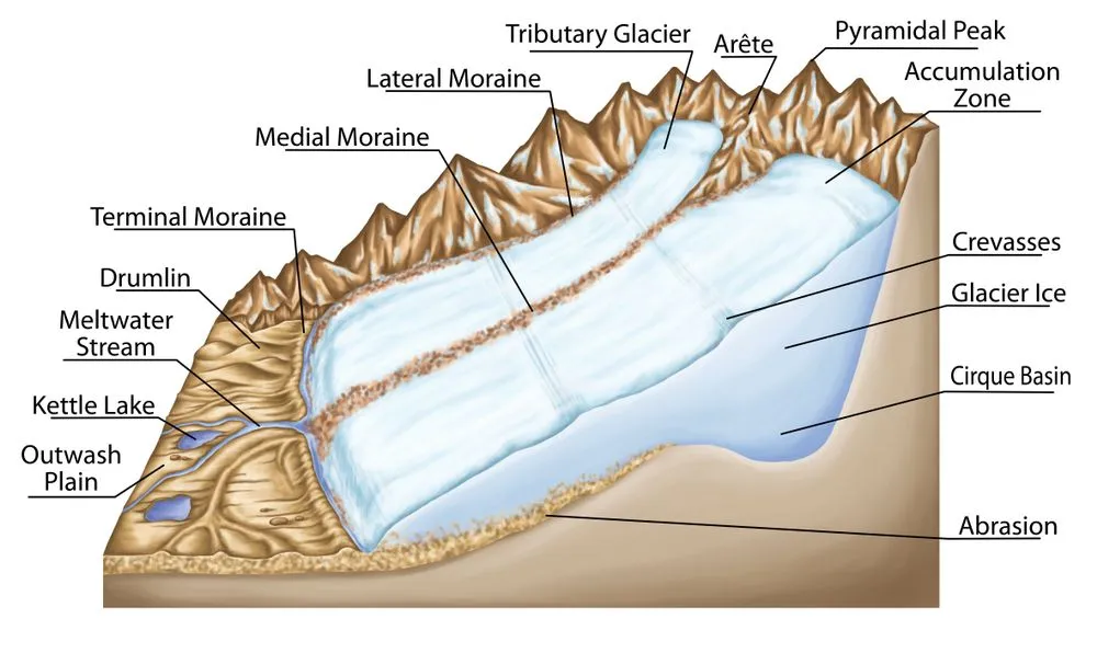
Landforms developed by glaciers are referred to as glacial landforms. Glaciers are nothing but moving rivers of ice. An excellent example of a glacial landform is the cirque (also called a corrie in Scotland or a cwm in Wales). Cirques are bowl-shaped hollows carved out of a mountain at the head of a glacier, where ice plucks and grinds away rock over thousands of years. When three or more cirques eat into the same mountain from different sides, the rock between them is whittled down into a sharp pyramidal peak, of which Switzerland's Matterhorn is the most famous example.
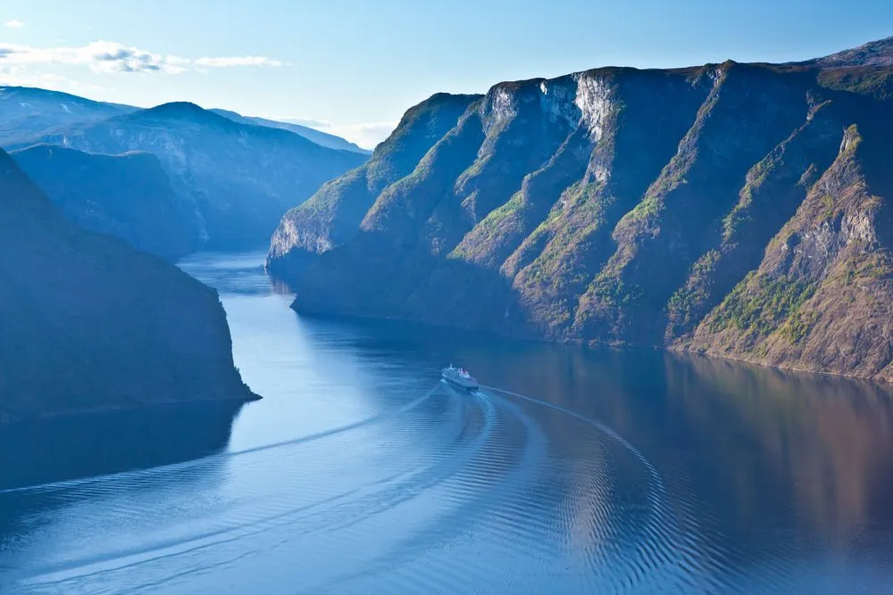
When we discuss glacial landforms, we certainly can’t forget about the majestic Fjords. Fjords are formed as a result of the submersion of V-shaped valleys in coastal regions. They play an essential role in the development of natural ports. The most common example of Fjords exists along the coast of Norway.
Moreover, outwash plains also fall in this category. Outwash plains are flat or gently sloping landscapes built from sand, gravel, and silt carried out from the snout of a retreating glacier by meltwater streams. Large portions of the upper Midwest in the United States (Wisconsin, Michigan, Minnesota, and the Long Island moraine in New York) sit on outwash deposits left behind by Pleistocene ice sheets, and the well-drained, mineral-rich soils that result are good farmland.
What Are Aeolian Landforms?
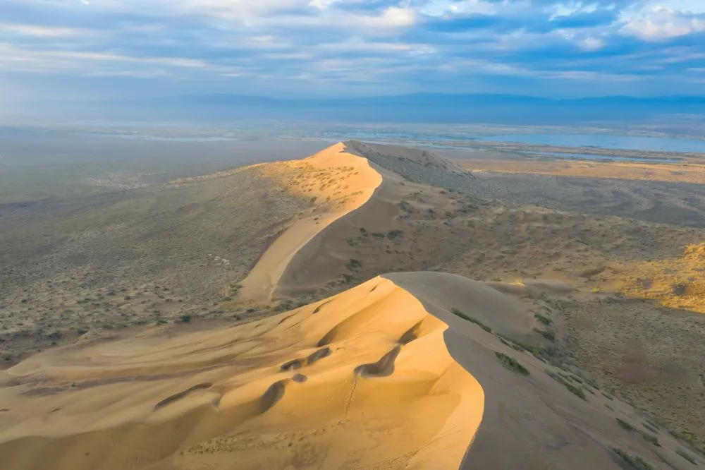
Did you ever consider that wind is also capable of giving rise to a landform? Perhaps not, but deserts, playas, and mushroom rocks are a few types of aeolian landforms. They are formed by the action of wind blowing with very high intensity.
Some excellent examples of such topographic wonders are the crescent-shaped sand dunes found in deserts, which are more formally known as barchans.
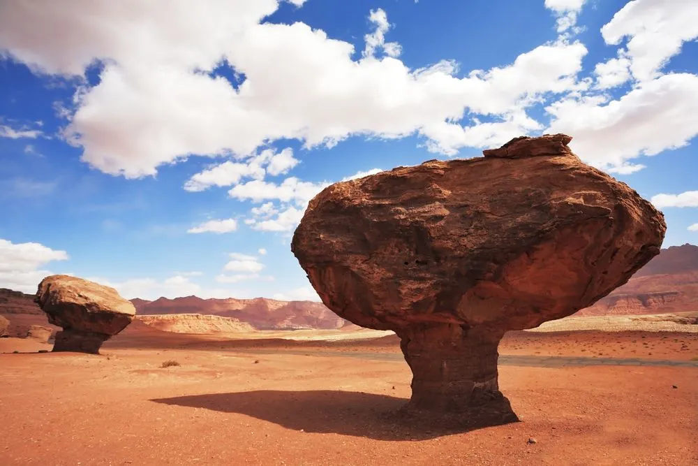
Pedestal rocks are also classified as aeolian forms. These rocks have a large upper part, although their base is very narrow, thereby resembling a mushroom. These rocks are also found in the regions which face very high intensity of wind. Such a high speed wind carves out the bottom part of these rocks by its abrasive action.
You have likely heard of Loess, which is regarded as the best agricultural soil in the world. It is nothing but an accumulation of windblown silt that gets piled up into a wondrous collection of rich soil!
What Are Tectonic And Volcanic Landforms?
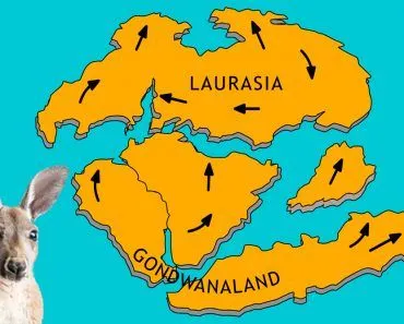
So far we have met landforms carved by rivers, ice, and wind, but some of the grandest features on Earth are pushed up from within the planet itself. Tectonic landforms are shaped by the slow movement of the giant plates that make up Earth’s rigid outer shell. Where two plates collide, thick layers of rock buckle and crumple upward into fold mountains, a repeating series of arches (anticlines) and troughs (synclines) that run roughly parallel to one another.

Elsewhere, the crust is pulled apart rather than squeezed together. As a plate stretches and thins, it snaps along normal faults, and long slabs of crust slip downward between them to form sunken rift valleys flanked by fault-block mountains. The Basin and Range country of Nevada and its neighboring states, and the Rio Grande Rift threading through Colorado, New Mexico, and Texas, are classic North American examples, while East Africa’s Great Rift Valley is slowly tearing that continent apart even today.
Volcanic landforms are close cousins, built wherever molten rock reaches the surface. Runny, free-flowing lava spreads out and heaps into broad, gently sloping shield volcanoes such as Hawaii’s Mauna Loa, while thicker, stickier magma erupts violently to raise steep-sided stratovolcanoes like Mount Rainier and Mount St. Helens. Repeated floods of runny lava can also blanket vast areas into flat lava plateaus, such as the Columbia River Plateau of the Pacific Northwest. And when a large volcano empties its magma chamber and its summit collapses inward, it leaves behind a giant basin called a caldera: Oregon’s Crater Lake fills one that formed when Mount Mazama collapsed roughly 7,700 years ago.
What Are Some Other Popular Landforms?
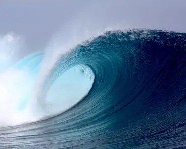
Apart from the landform forces mentioned above, there is another type that forms in limestone- and chalk-rich regions. This is known as karst. They give rise to pillars that are usually observed in caves. Moreover, cliffs, caves, sea stacks, sea arches, and lagoons constitute marine or coastal landforms, since they form due to erosion and deposition by sea waves and tides. Beaches are also included in this category.
Another famous, yet vulnerable, landform is the coral reef. Reefs are unique in that the landform itself is built by living animals: corals are tiny cnidarian polyps (close relatives of sea anemones and jellyfish) that secrete calcium-carbonate skeletons and live in colonies in tropical seas. They have a symbiotic relationship with photosynthetic dinoflagellates called Zooxanthellae (genus Symbiodinium) that supply most of their energy. Reefs need sediment-free, sunlit water and temperatures generally above 18 °C (64 °F), and they're increasingly vulnerable, with the 2023-24 fourth global coral-bleaching event the most extensive on record.
What Landforms Are Found In Rainforests?
A search for “rainforest landforms” is a common one, so it is worth clearing up a small confusion first: a tropical rainforest is not itself a landform but a type of forest. Even so, the hot, soaking-wet tropics do sculpt a distinctive family of landforms. Relentless heat and rainfall drive intense chemical weathering that can rot solid bedrock into soft, deep regolith more than 100 meters (330 feet) thick, so these landscapes are shaped as much by rock dissolving in place as by rock being broken and carried away.

The result is two very different kinds of scenery. In hilly and mountainous rainforest, fast streams saw deep, narrow, V-shaped valleys between sharp ridges, and rain-soaked slopes frequently give way in landslides. In the lowlands, enormous meandering rivers wind across wide floodplains: the Amazon and the Congo rank among the greatest rivers on Earth by the sheer volume of water they carry, their sluggish courses interrupted here and there by rapids and waterfalls where tougher rock resists erosion.
Rising above the canopy are the showpieces. Where a mass of especially resistant rock refuses to weather away, it can be left standing alone as an inselberg, a bald, isolated hill looming over the forest; the rounded granite and gneiss domes around Rio de Janeiro, Sugarloaf Mountain among them, are textbook examples. In the Guiana Highlands of northern South America, flat-topped sandstone table mountains called tepuis jut up like islands above the jungle. One of them, Auyán-tepui in Venezuela, is the launching point of Angel Falls, the tallest waterfall on Earth.
By knowing the causative agents behind the changes taking place, we can actively classify the different landforms on our planet, as explicated above. Having a geological perspective on Earth’s topography makes it all even more beautiful!
References (click to expand)
- Aeolian (Dunes) Landforms - Geology (U.S. ....
- Fluvial Landforms & Processes.
- Glaciers and Glacial Landforms - Geology (U.S. ....
- Leong G. C. (1995). Certificate Physical and Human Geography. Oxford University Press
- Landform (Encyclopaedia Britannica)
- Landforms (U.S. Geological Survey)
- Tectonic Landforms and Mountain Building (U.S. National Park Service)
- Volcanic Landforms (U.S. National Park Service)
- Continental Rift (U.S. National Park Service)
- Geomorphology of Wet Climate Areas (EBSCO Research Starters)
- Guiana Highlands (Encyclopaedia Britannica)