The Terai-Duar is a savanna and grassland ecosystem at the foothills of the Himalayas, spanning roughly 35,000 km² across India, Nepal and Bhutan. It holds the world’s tallest grasslands and supports Asia’s highest densities of tigers and greater one-horned rhinos, along with elephants, gaur and nilgai.
Savannas have become synonymous with Africa, where large herbivores like zebras, antelopes, and giraffes graze, while carnivores like cheetahs and lions prowl in search of prey.
However, savanna grassland ecosystems are present all across the world. They are characterized by vast stretches of grassy land interspersed with limited trees.
In the foothills of the mighty Himalayas, savannas take on a distinctly different appearance than savannas anywhere else on the planet. This unique landmass is known as the Terai-Duars savanna and grassland. It covers around 35,000 km² of the alluvial plains in India, Nepal and Bhutan.
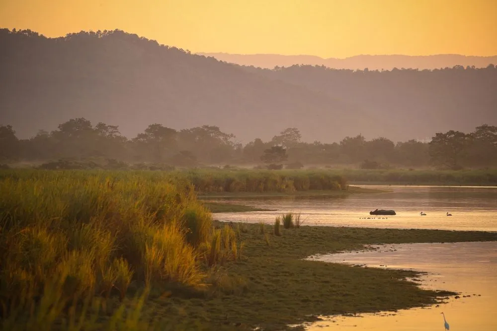
However, these grasslands have always been considered non-productive lands and have historically been converted to agricultural or plantation areas. The present alluvial grasslands of the Terai-Duars region represent the remnants of what was once an extensive savanna ecosystem.
Formation Of A Unique Habitat
This region was formed from the deposited silt from the Himalayan rivers and streams, including the Ganga, Brahmaputra and their tributaries. These rivers cascade down from the mountains of the Himalayas to the lowlands in the foothills. Huge silt loads that these rivers carry get deposited in the floodplains.
Over a million years, the Terai-Duars savanna has come into existence. Annual monsoon floods bring in new waves of silt deposition and recharge the soil’s nutrient content.
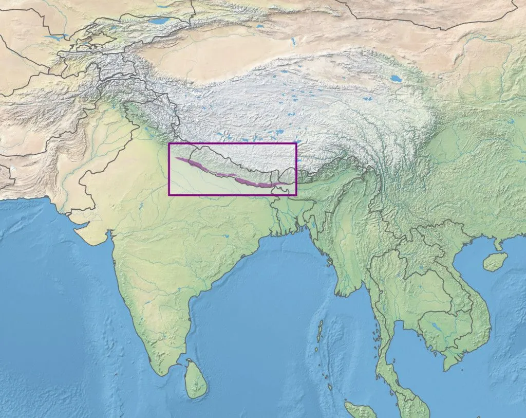
In the west, the Terai-Duars savanna starts from the Bhabar region in Uttarakhand and passes through the Indian states of Uttar Pradesh, Bihar, West Bengal, and Assam up to the Dhansiri River. Towards the north, it extends up to the Dang and Deukhuri valleys in Nepal.
River Teesta in West Bengal effectively divides the region into two unequal halves: the western part is called “Terai”, from the Hindi and Urdu word tarai, meaning ‘lands lying at the foot of a watershed’, and the eastern part, which serves as the gateway to Bhutan and is known as ‘Duars’, which is Bengali for a door or gateway.
Situated in areas with lower elevations, this region experiences hot and humid summers, followed by cold and dry winters. Annual rainfall is around 3500 mm and occurs mainly due to the southwest monsoons.
Why Is The Terai So Wet, And What Does Its Name Mean?
The name itself is a clue. Terai comes from the Hindi and Urdu word tarai, and it is usually translated as “moist land”, or lowland lying at the foot of a watershed. The wetness is not incidental; it is the very thing that builds the savanna.

Just above the Terai runs a narrow band of coarse gravel and shingle known as the Bhabar, laid down where rivers tumbling off the Shiwalik foothills abruptly lose their speed and drop their stony load. This gravel is so porous that the smaller streams simply sink into it and flow on underground rather than across the surface. A short distance to the south, that buried water meets finer, less permeable clays and is pushed back up to daylight along a long line of springs. The re-emerging groundwater keeps the Terai waterlogged for much of the year, feeding the marshes, oxbow ponds and tall wet grasslands that rhinos, swamp deer and wild water buffalo depend on.
East of the Teesta River the same belt carries a different name, the Duars, which is Bengali for “doors”, because its valley mouths form the gateways into the hills of Bhutan. Bhabar, Terai and Duars are really three readings of one landscape: the place where the Himalayas hand their water and silt over to the plains.
Flora And Fauna Of Terai-Duars
The nutrient-rich soil and tropical climate have promoted the formation of the world’s tallest grasslands in this region. The region is composed of riverine grasslands, along with a grassland-forest mosaic. Together, they support one of the highest densities of hooved animals on the planet, including deer, antelopes and rhinos.
Two species of grasses, locally known as kans and baruwa, dominate the tall grasslands. As one moves farther from the rivers, tall grasses gradually give way to shorter grasses. Eventually, the grasses blend with the naturally occurring sal forests in the foothills of the Himalayas.
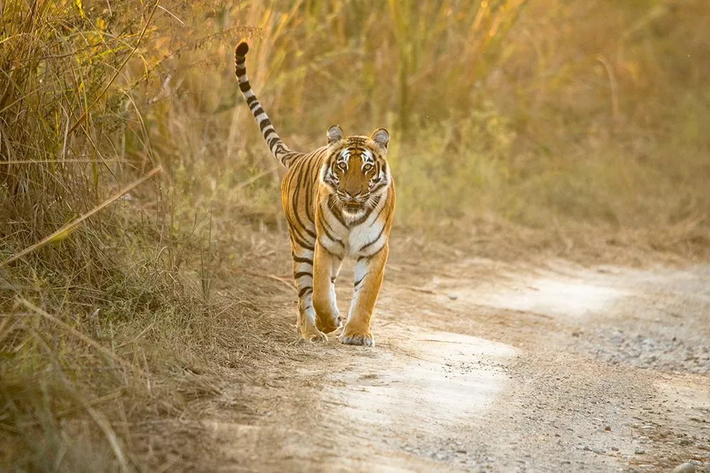
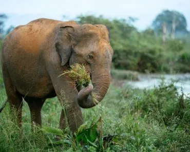
This assemblage of tall and short grasses, trees, marshes, water bodies, and rivers gives refuge to a huge number of herbivorous and carnivorous species. Five major deer species of Asia, namely the Indian hog deer, Swamp deer, Sambar, Indian muntjac and Chital, roam the Terai-Duars grasslands. These floodplains are also home to four of the largest-bodied herbivores in Asia, namely the Nilgai, Asian elephant, Greater one-horned rhinoceros, and Gaur. Some of the grassland areas also act as one of the last few refuges for the endangered Wild water buffalo.
Such an extravagant assembly of prey species encourages the presence of predators like the Bengal tiger, Indian leopard and Clouded leopard.
The region harbors the highest densities of tigers and rhinos in Asia. The Terai-Duars grassland ecosystem acts as one of the last refuges of many globally threatened species, such as the Pygmy hog, Hispid hare, Bengal florican, and Gharial.
How Malaria Saved The Terai, Then Settlement Nearly Erased It
Here is the strange twist in the story: for most of recorded history, malaria is what protected the Terai. The hot, humid, seasonally flooded forests were ideal breeding grounds for malarial mosquitoes, and the disease made the belt almost uninhabitable for outsiders. The one community that thrived there was the Tharu, an Indigenous people who had built up resistance to malaria over many generations. They cut thatch grass, grew rice along the riverbanks and grazed cattle in the open pasture, leaving most of the forest and grassland intact. Tigers, rhinos and elephants flourished behind this invisible wall of disease.

That wall came down quickly. In the mid-1950s, a government-led campaign, backed by the United States, began spraying DDT to wipe out malaria across the Terai, and by the early 1960s the disease was all but gone. Land-hungry families then streamed down from the overcrowded hills. In the Chitwan Valley alone, the human population climbed from roughly 36,000 in 1950 to around 100,000 within a decade, and close to 70% of the valley’s forest was cleared for farmland.
The wildlife collapsed along with its habitat. Chitwan’s greater one-horned rhinos crashed from an estimated 800 animals to fewer than 100 by 1970, surviving at all largely because the area had been set aside as a royal hunting reserve. The thin 2% of grassland that remains today is essentially what was left after this rush, which is exactly why the conservation effort described below matters so much.
Terai-Duars And The Age Of Humans
Currently, only 2% of the grassland cover is left on the Indian subcontinent. The World Wildlife Fund has declared this ecosystem as endangered. Illegal logging, poaching, land conversion, overgrazing by livestock, and the diversion of rivers and streams are the major threats to this landscape.
To conserve the last remaining Terai vegetation in the area, India and Nepal jointly launched a program called the Terai Arc Landscape (TAL), including a total of 14 protected areas from both countries. The effort has paid off for some flagship species: Nepal nearly tripled its wild tiger count from 121 in 2010 to 355 in 2022, and the greater one-horned rhino has recovered from fewer than 100 animals a century ago to roughly 4,000 across India and Nepal today.
One of the most famous and significant protected areas in Nepal is Chitwan National Park. It once served as the royal hunting grounds of Nepal’s emperor. Chitwan National Park, Parsa Wildlife Reserve and Valmiki National Park form the most important tiger conservation network in Nepal.
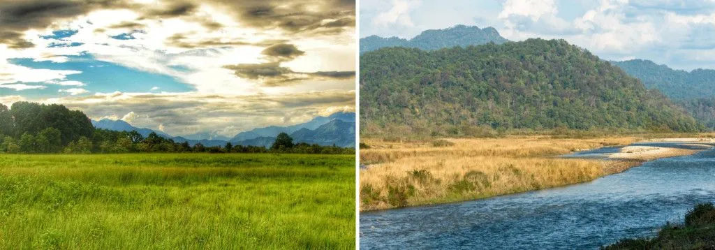
On the Indian side of the landscape, the most significant protected area is the Dudhwa Tiger Reserve, which is composed of Dudhwa National Park, Katarniaghat Wildlife Sanctuary, and Kishanpur Wildlife Sanctuary. Kishanpur is contiguous with the Shuklaphanta National Park in Nepal, creating a transboundary protected area network between India and Nepal. In India, the Terai-Duars savanna is part of the Manas National Park, a UNESCO World Heritage Site.
However, the declared protected areas are insufficient to conserve this unique yet heavily threatened ecosystem. Immediate action is necessary to better understand the ecology of these grasslands, which will help to protect the remnants of this once widespread and currently endangered ecosystem.
References (click to expand)
- J Ratnam. (2011) When is a 'forest' a savanna, and why does it matter?.
- NB Peet. (1999) Plant diversity in the threatened sub-tropical grasslands of ....
- DM Olson. (2002) The Global 200: Priority Ecoregions for Global Conservation.
- Present Status of Terai and Duars Region Biodiversity.
- https://www.sciencedirect.com/science/article/abs/pii/B9780124095489120585?via%3Dihub
- E Wikramanayake. (2010) The Terai Arc Landscape: A Tiger Conservation Success ....
- Terai. Encyclopaedia Britannica.
- N Subedi et al. (2013) Population status, structure and distribution of the greater one-horned rhinoceros Rhinoceros unicornis in Nepal. Oryx.
- Behind rising rhino numbers in Nepal, a complex human story. Mongabay.