Ancient geographers progressed from making maps of cities to maps of the entire world using travel descriptions, surveying and an insane amount of mathematics!
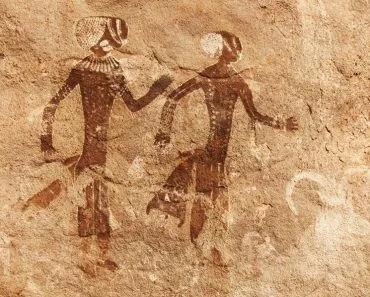
Contrary to the popular belief that maps depict places and rivers and roads, the earliest maps were actually representations of the night sky; more precisely, they were visual representations of the night-sky observations that people made. In 1963 in Turkey, a cave painting was discovered that had been drawn around 6200 BC in Catal Hyük in Anatolia. This painting illustrated a town with streets, houses and a volcano.
Would you call this a cave painting or an attempt at cartography? It remains unclear whether this illustration is a map or a mere painting, though many scientists have tried to decipher the mystery. However, this means that we, as a species, were keen to represent what we saw, which is what I believe led us to draw maps.
Which Is The Earliest Known Map?
One of the oldest known maps of the world comes from Babylon and was made around 600 BC on a clay tablet. It represents the interpretation of the world known to man at that time. There are multiple speculations about the map. Some think that the map was meant to represent the mythological places in which the Babylonians believed.
Others believe that the map actually does represent the ancient world, as this map uniquely illustrates the land beyond oceans, unlike the other maps of this period, which concentrate only on the place in which it was made. It is also speculated that the map was a way to determine how to route the surplus agricultural produce.
The actual intent behind the map is still disputed, but the map gives us interesting insight because it accurately represented the nearby cities and topography!
Who Invented Maps, And What Are Mapmakers Called?
So who actually invented the map? The honest answer is that no single person did. Maps are older than writing itself, and they appear independently across cultures, scratched onto clay, bark, stone and bone long before anyone thought to sign their work. The Babylonian Map of the World you just read about (often called the Imago Mundi) is the oldest known map of the world, but it is not the oldest map of any kind. Older local maps survive, including the Turin Papyrus Map from Egypt, drawn around 1150 BC to chart a gold-mining region of the Eastern Desert, and that one is usually called the oldest surviving topographical map.

When it comes to the first deliberate map of the whole world in the Western tradition, the name historians reach for is Anaximander of Miletus, the Greek thinker we will meet again below. Even so, crediting him as the inventor of maps would be unfair to the countless anonymous mapmakers who came before him.
And what do we call the people who make maps? They are cartographers, and the craft itself is cartography. Curiously, that word is far younger than the practice. It was coined only in the 19th century, borrowed into English from the French cartographie, stitching together the Latin carta (a map or sheet of papyrus) and the Greek graphein (to draw or write). So while humans have been drawing maps for thousands of years, we have had a tidy name for the job for only about two centuries!
Evolution Of Map-making Techniques
In the olden days, maps were mostly just a pictorial representation of a singular place. Like the 600 BC map that the Babylonians made, most maps were of a single place, its topography, and the nearby roads and cities. These maps were made with a mix of information available from traveler accounts, science hypotheses, literature and reports from navigators.
Anaximander: The First Cartographer
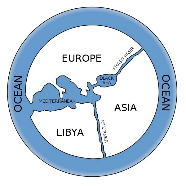
A world map didn’t come around until the 6th century BC. Anaximander, the first cartographer made a representation of the world at that time. The original map does not survive, but from Herodotus’ description, it was a circular map wherein land was enclosed in a water body.
Habitable Greece was in the center, along with the Mediterranean Sea. The northern part was Europe and the southern part was Asia. It was nothing very specific, but still quite impressive!
From that point on, maps only became more detailed as more and more areas were explored and written about in the maps. These maps still followed the same pattern of being circular, surrounded by sea on all sides, but these maps had more details about places in Asia and Europe.
Map-making was not restricted to the Greeks; the Chinese also made maps on silk and wooden blocks that date back to the 4th century.
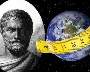
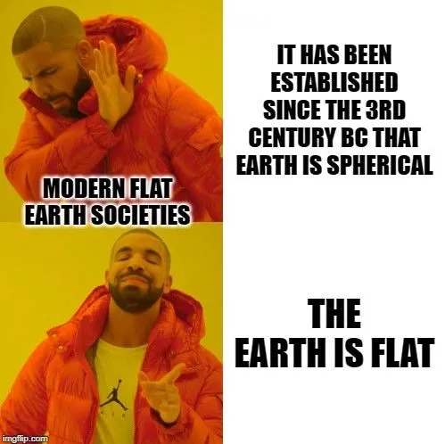
In the 3rd century, Eratosthenes successfully calculated the circumference of the earth, and it was established that the earth was actually spherical, and not flat. This discovery also led to subsequent changes in the field of cartography.
The Greeks used the stade as the measure of distance and it was popular to hire bematists, people who counted the distance between two places by traveling the distance on foot. The time taken by people to travel between places was used as a measure of distance. All of this data gradually helped people know the size and distance of particular places.
Triangulation: A Mathematical Technique To Measure Distances
It might surprise you if I said that map-making was connected more to mathematics than geography during ancient times, but it’s true. Map-making was essentially an art that used mathematical methods like triangulation! If you know the angles and distances between places, it was possible to calculate the distance between them; this was the most commonly used technique during those times. This method of triangulation is still used today but in a far more sophisticated way.
Eratosthenes’s Map
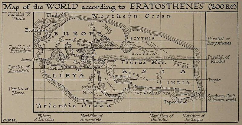
Eratosthenes also developed a grid that helped him locate places. He designated a line passing through Rhodes and the Pillars of Hercules (present-day Gibraltar) as one of the chief lines of his grid. This line divided the world into two fairly equal parts and defined the longest east-west extent known.
He chose a line through Rhodes as the main axis for the north-south grid lines. Then he drew seven parallel lines to both the main axes, which formed a rectangular grid. It was with this grid’s help that he was able to locate places on the first world map!
Ptolemy’s Map
Ptolemy created a map of the world in the 2nd century AD using the longitudes and latitudes that we still use today. Ptolemy’s work is similar to Eratosthenes’ map, but his work is more recognized, due to the fact that he not only made a map, but also wrote a book about how he drew the map.
His work is based on the work of his predecessors, but his book on Geography is extraordinary in the sense that he explained the stepwise procedure to drawing the map so that people could replicate the map-making technique anywhere. His book was later translated and helped the Arabs replicate his map, as well as add details to the world map.
Maps gradually became much more detailed as new regions were explored and put down on paper. Also, mathematical and astronomical advances helped to perfect the world map to what we know and love today!
How Did They Make Maps Before Satellites?
For most of history, mapmakers had no view from above at all. They stood on the ground and reasoned their way to a bird's-eye picture using geometry, careful measurement and a great deal of patience. Two problems dominated their work: fixing your position on land, and fixing it at sea.
At sea, sailors could find their latitude from the height of the Sun or the Pole Star, but longitude (how far east or west you were) was a nightmare that wrecked ships and skewed every chart. Britain's Parliament took the problem so seriously that in 1714 it passed the Longitude Act, offering a reward of up to £20,000, a fortune at the time, for a workable solution. The self-taught clockmaker John Harrison eventually delivered one with his marine chronometer. His H4 timepiece, tested on Atlantic voyages between 1761 and 1764, kept such accurate time that a navigator could compare local noon with the time back in Greenwich and turn the gap into longitude, since every hour of difference equals 15 degrees. Once chronometers spread through the 1800s, sea charts became far more reliable.

On land, the workhorse was triangulation, the same trick the ancient Greeks dabbled in, now armed with precision instruments. Surveyors measured a single baseline very carefully, then used a theodolite to read the angles to distant landmarks, letting trigonometry fill in a web of triangles across an entire country. France's Cassini family completed the first nationwide triangulated survey in the 18th century, and Britain's Great Trigonometrical Survey of India, begun in 1802 from a baseline near Madras, blanketed the subcontinent in triangles and, along the way, measured the heights of the Himalayan peaks.
Then came the view from above after all. In 1858 the French photographer Nadar took the first aerial photograph from a balloon over Paris, and during World War I aerial photography matured into a serious mapping tool. By the 1930s a technique called photogrammetry let cartographers build maps from overlapping aerial photos: viewed through a stereoscope or stereoplotter, the overlap snapped into three dimensions, and an operator could trace contours, rivers and roads straight off that model. The U.S. Geological Survey adopted the method for topographic mapping in the 1930s, and aerial photographs remained the backbone of map-making right up until satellites took over.
Why Did People Make Maps In Ancient Times?
This shouldn’t be hard to guess, as the purpose of maps hasn’t changed over the years! Maps were made to facilitate navigation and outline the topographical features of a given place. Maps were typically made with the place in question at the center, which means that a world map didn’t initially exist. However, as trade and travel increased, people discovered new regions and thus developed more comprehensive and expansive maps.
Mapping was particularly helpful for seafarers, as it helped them mark ports and explore territories without getting lost. Maps provide an alternative to textual description; furthermore, trade routes and passages put on a map can reach wider audiences than what might have spread by word of mouth.
It’s actually quite astonishing that maps have been around for so long. In this day and age of GPS and Google Maps, we hardly understand the incredible evolution of cartography! You might feel that reading a map is hard, but the realization that people spent centuries perfecting this art of making a map boggles the mind! For starting as an effort to pictorially represent a city, cartography has come a long way to its various representations of the whole world! Even so, we humans certainly have a long way to go!
References (click to expand)
- Cartography - MacTutor History of Mathematics Archive. The MacTutor History of Mathematics archive
- The Babylonian map of the world sheds light on ancient .... ancient-origins.net
- Coming of Age in Cartography: Evolution of the World Map. amusingplanet.com
- Anaximander | Internet Encyclopedia of Philosophy. The Internet Encyclopedia of Philosophy
- Babylonian Map of the World: The oldest known map of the ancient world. Live Science
- The oldest geological map of mankind: The Turin Gold mine Papyrus. Museo Egizio
- Cartography - Etymology, Origin and Meaning. Online Etymology Dictionary
- Longitude found - the story of Harrison's timekeepers. Royal Museums Greenwich
- The Great Trigonometrical Survey. University of Michigan Library Online Exhibits
- Topographic Mapping. U.S. Geological Survey
- Photogrammetry. Encyclopaedia Britannica