Table of Contents (click to expand)
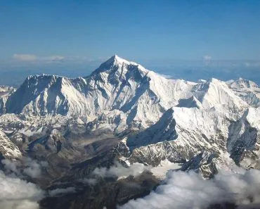
Mt. Everest is the highest point on Earth above sea level, at 8,848.86 m (29,031.7 ft). By that measure it is the tallest mountain in the world. Hawaii's Mauna Kea, however, rises about 10,211 m (33,500 ft) from its base on the Pacific seafloor, making it taller from base to summit, though most of it lies underwater.
While Titanic is one of the most widely watched movies in history, we know what fateful end it met. If you haven’t watched it yet… spoiler dead ahead!
As we swooned over the majestic love story of Rose and Jack, our expectations were shattered by the tragic ending. The Titanic hit a catastrophic iceberg and split in two, finally leading to the separation of the two star-crossed lovers.
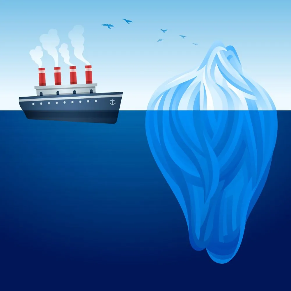
If all the water from all the oceans was taken out, we would see that the ocean floor is not a plain and flat surface. It also has landforms like mountains and plateaus. Although an iceberg is not one of these landforms, it does confirm our belief that there may be solid masses beneath the surface of the liquid ocean.
So, if there are mountains rising from the floor of oceans, is Mount Everest actually the tallest mountain on planet Earth?
Which Is The Tallest Mountain?
Mt. Everest stands 8,848.86 m (29,031.7 ft) above sea level, the figure jointly confirmed by Nepal and China in December 2020, and is considered the tallest mountain on Earth. However, you may be surprised to know that it has some fierce competition. Mauna Kea, a dormant volcano on the Big Island of Hawaii, rises roughly 10,211 m (33,500 ft) from its base on the Pacific seafloor to its summit, making it the tallest landform on the planet from base to top.
If that’s the case, why is Mt. Everest given the number one position?
The simple catch is that when Mauna Kea’s “above sea level” height is considered, it turns out to be only 4,205 m (13,796 ft). The other roughly 6,000 m of the volcano is submerged in the Pacific Ocean. Mt. Everest, on the other hand, rises from the land itself, so its 8,848.86 m is measured entirely above sea level.
By understanding the differences in the formation of these two mountains, it’ll be easier to decide whether Mt. Everest should or should not be declared the undisputed champion.
The Plate Tectonic Theory
To understand the formation of mountains, it is important to know about the plate tectonic theory. According to this theory, the outer layer of the earth or the lithosphere, is divided into many tectonic plates. They are irregularly shaped and composed of solid rock.
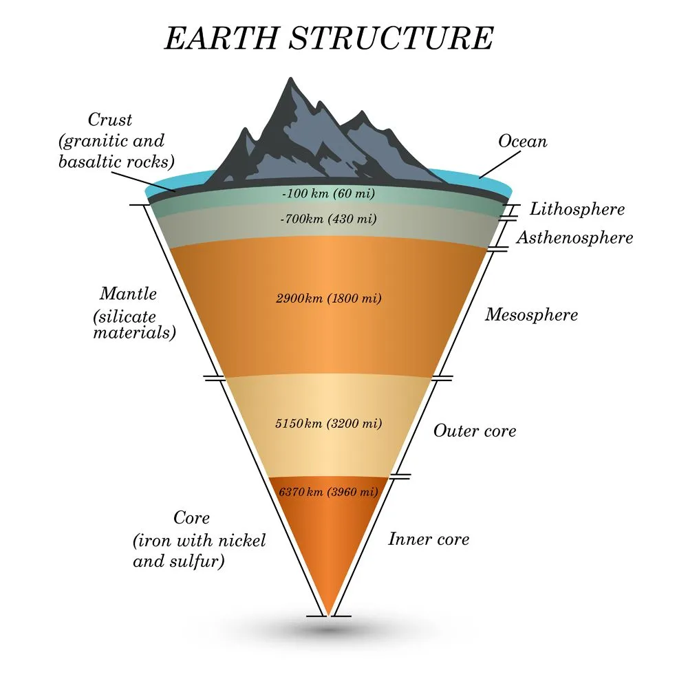
These plates continuously move over the asthenosphere, which is a semi-molten layer. There are seven major and a number of minor plates covering the planet. Since the Earth was formed, the plates have been in continuous motion. This has led to the varied positions of continents over time. It has also led to the formation of new and myriad landmasses, such as mountains and volcanoes. This is due to the different kinds of plate boundaries.
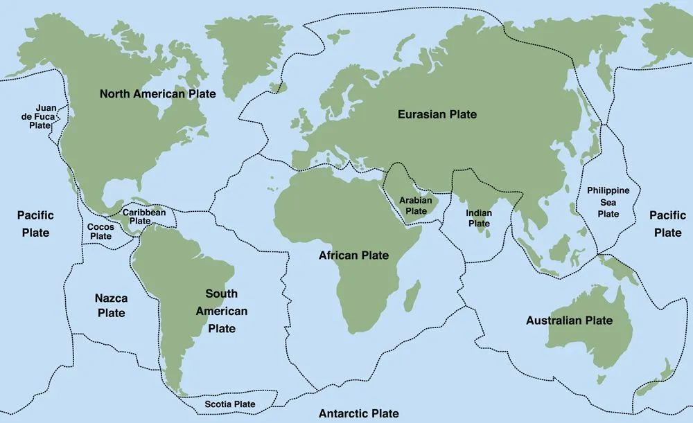
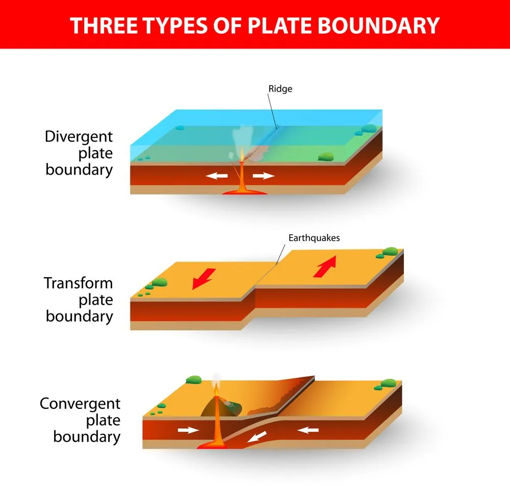
Plate boundaries are not the boundaries of the continents of today, but actually pass through the continents and even the oceans. There are three kinds of plate boundaries.
Divergent boundaries are those where plates move away from each other and new crust is generated. Convergent boundaries are those where plates move towards each other. One plate subducts under another and crust is destroyed. Transform boundaries are those that slide past each other.
How Did Mt. Everest Form?
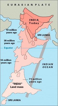
The Indian subcontinent used to be a large island around 225 million years ago. It was separated by the Tethys Sea from the Asian continent. Then, about 200 million years ago, it started drifting northwards towards Asia. Its movement continued for millions of years until roughly 50 million years ago, when the leading edge of the Indian plate began to collide with Eurasia (the full continental collision was complete by about 40 million years ago). The collision crumpled and uplifted the crust caught between the Indian and Eurasian plates. Thus rose the Himalayan range of mountains. The two plates are still pushing into each other today, with India creeping north at roughly 4 to 5 cm per year, which is why the Himalayas are still growing.
Out of the many peaks of the Himalayan range, Mt. Everest rose the highest. It took roughly 50 million years for Everest to reach the height it is today, and it is still getting taller, by about 4 to 5 mm per year, according to GPS measurements from the Survey of Nepal. Because Everest was built by folding and faulting of sedimentary and metamorphic rock (not by erupting magma), it is a fold mountain and not a volcano. In fact, marine fossils have been found near the summit, a clue that the rock there once sat on the floor of the ancient Tethys Sea.
How Did Mauna Kea Form?
With a total height of about 10,211 m when measured from the ocean floor, Mauna Kea’s process of formation is very different from that of Mt. Everest.
Apart from plate boundaries, there are also places on Earth called hotspots. These are narrow regions where unusually hot rock rises towards the surface in the form of a mantle plume. The largest plumes are thought to begin at the core-mantle boundary, roughly 2,900 km (1,800 mi) down, where the deep mantle is heated by the underlying liquid iron-nickel outer core. As the plume rises, the drop in pressure causes mantle rock to partially melt, forming magma. The point where this magma reaches the surface is called a hotspot.
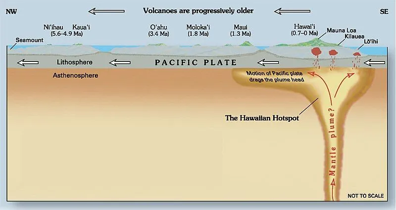
When a plume erupts as magma on the seafloor, lava piles up on the same spot eruption after eruption, eventually breaking the ocean surface as a volcanic island. The Hawaiian chain of islands is a classic example of island building over a mantle plume, and Mauna Kea is part of this chain.
The presence of a chain (rather than a single mountain) indicates that the plate beneath, the Pacific plate, is in constant motion. As the plate slides over the stationary hotspot, each new volcano is conveyor-belted away from the heat source while a fresh one starts forming behind it. If the plate had remained still, only one large island would have been created.
So this process of magma upwelling not only built up the tallest mountain on Earth from base to summit, but also one of the world’s most famous holiday destinations (the Hawaiian islands).
Conclusion
In case you’re wondering why Mt. Everest is still considered the tallest mountain on Earth, the rationale is quite straightforward. It comes down to how you measure. Whenever height above sea level is the yardstick, Mt. Everest, at 8,848.86 m, remains the undisputed winner. However, when total height from base to summit is measured, Mauna Kea (at about 10,211 m) grabs first place. And if you go by distance from the center of the Earth instead, the equatorial bulge hands the crown to Ecuador’s Mt. Chimborazo. The “tallest mountain on Earth” really depends on where you choose to put your tape measure.
References (click to expand)
- Textbooks PDF (I-XII) - NCERT.
- Plate Tectonic Theory: Plates and Interplate Relationships. James Madison University
- The Himalayas: Two Continents Collide. The United States Geological Survey
- What is a Hot Spot? | Volcano World | Oregon State University - volcano.oregonstate.edu
- Hawaii Center for Volcanology | Mauna Kea. The University of Hawaiʻi System
- The Geology and Petrology of Mauna Kea Volcano, Hawaii. The United States Geological Survey