The path of the ISS appears like a wave on a map because it is a projection of a 3-dimensional path onto a 2-dimensional map. The ISS actually follows a nearly circular path around Earth, but this is not evident on a 2-dimensional map.
If you’ve ever seen the footage of an artificial satellite’s orbit, this is what you would have seen:
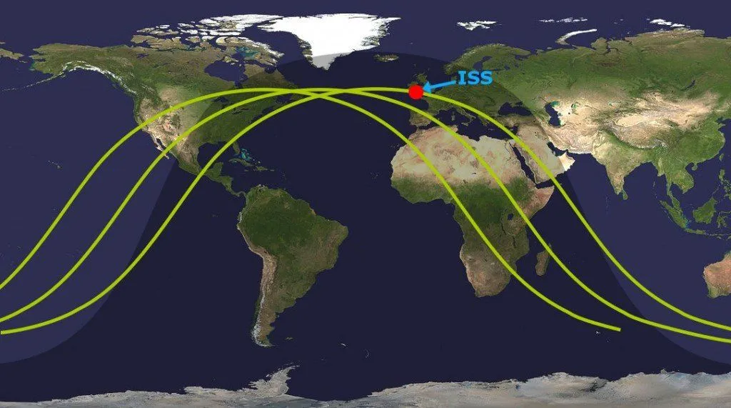
From the image given above, it’s evident that the satellite has a wave-like orbit, but doesn’t it look a bit unusual for a satellite’s path around Earth? It certainly doesn’t seem very efficient! The question is, do all artificial satellites, including the ISS, really have such wavy orbits when they circle Earth?
Why The ISS Path Appears Like A Wave On The Map Of The World?
Short answer: The ISS, just like any other artificial satellite, follows a nearly circular path around Earth. The reason its orbit looks like a wave on a map is that the orbit is 3-dimensional in nature, but when its ground track is projected on a 2-D Mercator map of the world, it flattens and appears distorted, producing a sinusoidal wave pattern.
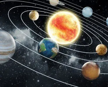
Although all artificial satellites trace a (nearly) circular path around the planet, in this article, we will only consider the ISS.
ISS Orbit Around Earth
Every space enthusiast knows about the International Space Station – a habitable artificial satellite that acts as a manned space station in low Earth orbit and typically hosts a crew of seven astronauts who conduct different kinds of scientific and technological research onboard. The ISS has been continuously occupied since November 2000 and is currently planned to operate until 2030, after which it will be safely deorbited.
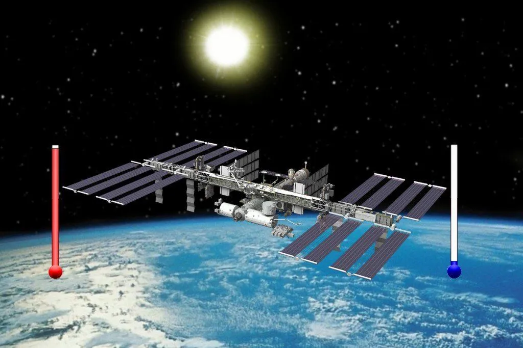
Just like any other artificial satellite, the ISS also circles Earth in a predefined path, called an orbit. The ISS’ orbit is located at an altitude above Earth where it still experiences a strong gravitational pull from Earth. Contrary to popular belief, it’s not ‘zero gravity’ up there… not by a long shot. In fact, the ISS experiences as much as 90% of the gravity that we experience back here on Earth. It’s perpetually falling towards the Earth, but thanks to its huge orbital speed (17,150 mph/27,600 kmph) and Earth’s rotundity, it never actually hits the surface.
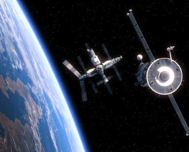
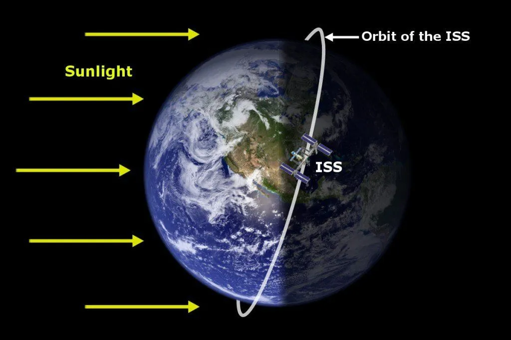
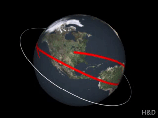
One noteworthy thing about the ISS orbit is that it doesn’t coincide with Earth’s equator. The ISS orbits at an inclination of 51.6 degrees relative to the equator. This inclination was chosen so that the station could be reached by Russian launch vehicles from the Baikonur Cosmodrome. Whenever we talk about a satellite revolving around the Earth, we generally tend to visualize its orbit coinciding with the equator, but in reality, the ISS orbit looks more like this:
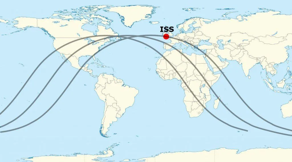
It’s evident from the picture above that the ISS follows a circular path around the planet. Still, when the same path is represented on the world map, it undergoes a drastic change to look like this:
Why the dramatic change?
The Mercator Projection
The maps that we saw in schools when we were kids, the maps shown on TV… basically (almost) every world map that we come across is wrong.

There’s actually a good reason behind that. You see, our planet is a 3D object, whereas maps are always 2-dimensional. In order for us to see and visualize the boundaries of countries and large land masses on the face of the Earth, we need a way to project all that 3-dimensional stuff onto a 2-dimensional piece of paper. That’s exactly what a Mercator map does.
It nicely represents physical features and land masses of the world on a rectangular sheet of paper, where latitudes and longitudes are straight lines that intersect perpendicularly and the shapes of countries are well-defined. However, apart from causing certain problems when it comes to the relative sizes of countries, the Mercator projection also distorts the path of the ISS on the world map.
Projecting The ISS Orbit Looks Like A Wave On A 2-D Map
The path you see on a flat map is technically called a "ground track" – it is the vertical projection of the satellite's orbit onto Earth's surface. The ISS ground track looks wavy because the ISS orbit is tilted at 51.6 degrees relative to the equator, but the Mercator map forces it onto a flat, rectangular surface.
Below is an animation that will help you visualize and understand this with more clarity:
If you represent the orbit of the ISS how it really is (i.e., circular) on a 2D map, then the equator would appear like a sinusoidal wave. Because the ISS orbit is inclined at 51.6 degrees, its ground track reaches a maximum latitude of 51.6°N and a minimum latitude of 51.6°S. The wave pattern also shifts westward with each orbit because the Earth rotates approximately 22.5 degrees eastward during each 90-minute orbital period.
In a nutshell, the path of the ISS (and other artificial satellites) appears like a wave because it’s projected onto a 2-D screen, and not because artificial satellites follow a wavy path around Earth. The technical term for this projected path is the satellite’s “ground track,” and its sinusoidal shape is entirely an artifact of mapping a 3-dimensional circular orbit onto a 2-dimensional surface.
How High Is The ISS, And How Fast Does It Orbit?
If the ground track is the "where", these are the "how high" and "how fast" that readers usually ask next. The ISS circles Earth at an altitude of roughly 400 km (about 250 miles), which sits well inside low Earth orbit. That is close enough that the atmosphere still produces a faint drag, so the station is periodically reboosted to keep from spiralling downward.
To stay in that orbit, the ISS travels astonishingly fast, at about 28,000 km/h (roughly 17,500 mph), or close to 8 km every second. At that speed, one full lap around the planet takes only about 90 minutes. Do the arithmetic across a 24-hour day and the station completes roughly 16 orbits of Earth. That is why astronauts onboard famously witness about 16 sunrises and 16 sunsets every day, since each orbit carries them from Earth's day side into its night side and back again.
This combination of low altitude and blistering speed is exactly what produces the tight, repeating wave you see on the map. A slower, higher satellite would trace a lazier curve, but the ISS races around so quickly that its ground track sketches out a fresh sinusoidal pass every hour and a half.
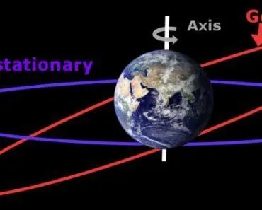
Does The ISS Rotate With Earth, Or Is It Geostationary?
A common follow-up question is whether the ISS hovers over one spot, "rotating with" the Earth the way a fixed camera might. It does not. The ISS is not in a geostationary orbit. Because it laps the planet roughly 16 times a day while Earth turns just once beneath it, the station is constantly moving relative to the ground, which is the very reason its ground track keeps sliding westward across the map.

A truly geostationary satellite is a different beast. It sits far higher up, at about 35,786 km (roughly 22,200 miles) above the equator, and orbits west to east at exactly the rate Earth spins. From the ground it appears to hang motionless over a single point, which is ideal for communications and weather satellites. On a Mercator map, a geostationary satellite's ground track collapses to a single dot, not a wave, because it never moves relative to the surface. The ISS, sitting nearly 90 times closer to Earth, does the opposite: it sweeps across the globe again and again, and that relentless motion is what paints the sinusoidal pattern in the first place.
References (click to expand)
- International Space Station - Wikipedia. Wikipedia
- Mercator projection - Wikipedia. Wikipedia
- Ground track - Wikipedia. Wikipedia
- (2015) International Space Station - NASA. The National Aeronautics and Space Administration
- Space Station Facts and Figures - NASA
- Space Station Orbit Tutorial - NASA Johnson Space Center
- Geostationary orbit - European Space Agency