Table of Contents (click to expand)
- Geosynchronous Vs Geostationary Satellites
- Difference Between Geostationary And Geosynchronous Satellite
- Geostationary Satellite Examples
- How High Is A Geosynchronous Orbit, And How Long Does One Lap Take?
- Why Does A Geostationary Satellite Have To Sit Above The Equator?
- Geosynchronous Vs Sun-Synchronous Orbit: What’s The Difference?
- What Are Geosynchronous And Geostationary Satellites Used For?
A geosynchronous satellite has an orbital period equal to one sidereal day (23 h 56 m 4 s), so it returns to the same spot in the sky every day. A geostationary satellite is a special case: it sits on a perfectly circular orbit in the equatorial plane at 35,786 km altitude, so it appears to hang motionless above one point on the equator. Every geostationary satellite is geosynchronous; not every geosynchronous satellite is geostationary.
In other words, a geosynchronous satellite revolves around the planet at the same speed at which the planet rotates on its axis. That’s the reason why this kind of satellite appears to be in the same region in the sky (at a given time of the day) when viewed from a particular position on Earth.
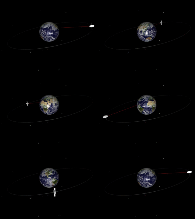
The orbital period of a geosynchronous satellite is a sidereal day, i.e., 23 hours, 56 minutes and 4 seconds, which is why it seems to stay in place over a single longitude (although it may drift south/north depending upon the orbit’s inclination with Earth’s equatorial plane).
Geosynchronous Vs Geostationary Satellites
The orbits where geosynchronous satellites revolve are known as geosynchronous orbits. A satellite that’s in a geosynchronous orbit appears at exactly the same spot in the sky after a period of one sidereal day, when viewed from a specific position on Earth. Geosynchronous orbits that are circular in shape have a radius of 26,199 miles (42,164 km).
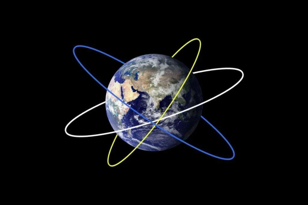
If the same satellite is observed for an entire day from a particular position on the ground, it either drifts north or south (it traces a distorted path like the number ‘8’) or remains stationary in the same spot.
A satellite of the latter kind is known as a geostationary satellite and it plays an instrumental role in global communications and weather forecasting. However, many people get confused between geosynchronous and geostationary satellites, and tend to assume that both are basically the same thing. As it so happens, that’s simply not true.
Difference Between Geostationary And Geosynchronous Satellite
A geostationary orbit (also known as a geostationary Earth orbit, geosynchronous equatorial orbit, or simply GEO) is a circular orbit located at an altitude of 35,786 kilometers (22,236 miles) above the surface of Earth with zero inclination to the equatorial plane. A satellite in this orbit is known as a geostationary satellite, and has an orbital period of one sidereal day (23 hours, 56 minutes and 4 seconds), which means that it completes one revolution around Earth in exactly the same time as Earth completes one rotation on its axis.
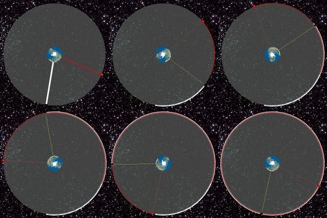
Since a geostationary satellite has the same orbital period as Earth, and it also travels from west to east (the direction in which Earth rotates on its axis), it therefore appears to hover at a single point in the sky when observed from a given point on the ground. Hence, the name ‘geostationary’, as it appears “stationary” from a given geographical location.
A Geostationary Satellite Is A ‘Type’ Of Geosynchronous Satellite
Looking at the definitions of both geostationary and geosynchronous orbits outlined above, it’s quite clear that there is very little difference between the two. A satellite in geosynchronous orbit has the same orbital period, i.e., one sidereal day, as that of a satellite in a geostationary orbit.
The only difference between the two is that while a geosynchronous satellite may or may not be following an inclined orbit (with respect to the equatorial plane), a geostationary satellite has to follow a non-inclined orbit. In other words, a geostationary satellite remains exactly above the Earth’s equator at all times. The following image should help you understand the difference better:
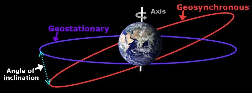
Therefore, ‘every’ geostationary satellite is a geosynchronous satellite, but it’s not (necessarily) true the other way round, i.e., a geosynchronous satellite may or may not be geostationary. You could also say that geostationary satellites are a subset of geosynchronous satellites.
Geostationary Satellite Examples
Some examples of geostationary satellites are the American GOES (Geostationary Operational Environmental Satellite) series, the Indian INSAT satellites, Japanese Himawari, European Meteosat (operated by EUMETSAT) and Chinese Fengyun. Note that since all these satellites fall under a particular category of geosynchronous satellites, they are also categorized as geosynchronous satellites.
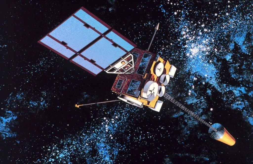
Examples of geosynchronous satellites that follow inclined orbits include the Russian Raduga 29, the Luxembourg-based SES Astra 1C, Malaysia’s MEASAT 2, and Japan’s QZSS constellation, which uses a highly inclined geosynchronous orbit to keep at least one satellite high in the sky over Japan at all times.
Geosynchronous satellites are typically used for a wide variety of purposes, such as relaying signals to and from low-Earth-orbit spacecraft such as the Hubble Space Telescope and the International Space Station (NASA’s TDRS fleet sits in geosynchronous orbit specifically to do this), voice communication, satellite internet, broadcasting cable TV and radio signals, and weather forecasting. Geostationary satellites, in particular, can give you detailed terrestrial and weather-related information about a particular geographical region, making them an ideal choice to predict climate trends in that region – or even act as a spy satellite!

How High Is A Geosynchronous Orbit, And How Long Does One Lap Take?
This is one of the most common questions people have about these satellites, so let’s pin down the actual numbers. A geosynchronous satellite sits roughly 35,786 km (22,236 miles) above Earth’s surface. Measured from the center of the planet rather than the surface, that works out to an orbital radius of about 42,164 km (26,199 miles). NASA describes this altitude as a “sweet spot” in which the satellite’s orbit matches Earth’s rotation, which is exactly why it appears to hover.

Why that exact height and no other? The altitude isn’t a design choice that engineers are free to tweak; it falls straight out of orbital physics. For a circular orbit, the time it takes to go around once depends only on the orbit’s radius. Plug a one sidereal-day period (23 hours, 56 minutes and 4 seconds, or about 86,164 seconds) into the orbital-period equation, and the only radius that satisfies it is 42,164 km from Earth’s center. As NASA puts it, “the higher a satellite’s orbit, the slower it moves,” so there is exactly one altitude at which a satellite’s lap time equals one Earth rotation. Go any lower and it laps the planet too quickly; go any higher and it falls behind. So whenever a quiz asks for the orbital period of a geosynchronous satellite, the answer is one sidereal day, very close to 24 hours.
Why Does A Geostationary Satellite Have To Sit Above The Equator?
Plenty of geosynchronous satellites are tilted relative to the equator, yet a truly geostationary one (the kind that never budges in the sky) must hang directly over the equator. The reason comes down to a simple rule of orbital mechanics: every closed orbit lies in a flat plane, and that plane has to pass through Earth’s center of mass, because gravity always pulls toward the center.

Now think about what “stays over one spot” really demands. Earth turns about its polar axis, so the only orbital plane that spins along with the planet without wobbling north or south is the one that contains the equator. Tilt the orbit even slightly, and the satellite spends half its day north of the equator and half south of it, tracing that lopsided figure-eight in the sky. It’s still geosynchronous (it comes back to the same place once a day), but it’s no longer motionless. Only a zero-inclination, perfectly circular equatorial orbit gives you a satellite that appears nailed to a single point. That’s also why countries negotiate for specific “slots” along the equatorial ring: there is just one such circle to share.
Geosynchronous Vs Sun-Synchronous Orbit: What’s The Difference?
People often mix up geosynchronous and sun-synchronous orbits because the names rhyme, but the two are about as different as orbits get. A geosynchronous orbit syncs with the rotation of the Earth; a sun-synchronous orbit syncs with the Sun.

A sun-synchronous orbit is a low, near-polar orbit, typically only 600 to 800 km (about 370 to 500 miles) up and tilted close to 98° to the equator. It’s carefully tuned so that the satellite passes over any given latitude at the same local solar time on every orbit. As NASA explains, this “keeps the angle of sunlight on the surface of the Earth as consistent as possible,” which is exactly what you want for imaging and Earth-observation satellites, since photos taken weeks apart have matching lighting and shadows. A geosynchronous (or geostationary) orbit, by contrast, is a high equatorial orbit at 35,786 km that keeps the satellite parked over one spot. So a weather imaging mission that needs the whole globe at consistent lighting flies sun-synchronous and low; a TV-broadcast or live-weather satellite that needs to stare at one region flies geostationary and high.
What Are Geosynchronous And Geostationary Satellites Used For?
Because a geostationary satellite hangs over a fixed patch of ground, your satellite dish can simply point at one spot in the sky and never move again. That single property is what makes this orbit so valuable. The big real-world uses are:
- Weather monitoring. The U.S. GOES (Geostationary Operational Environmental Satellite) fleet, run by NOAA, keeps a constant watch for the triggers of severe weather such as tornadoes, flash floods and hurricanes, refreshing imagery as often as every 30 seconds and tracking storms as they develop.
- Broadcasting and communications. Cable TV, satellite radio, satellite internet and long-distance voice links all bounce signals off geostationary satellites, since a fixed dish only works if the target stays put.
- Relaying data from other spacecraft. NASA’s Tracking and Data Relay Satellites (TDRS) sit in geosynchronous orbit specifically to ferry signals to and from low-orbit craft like the Hubble Space Telescope and the International Space Station.

One common point of confusion: GPS satellites are not geosynchronous. They fly in medium Earth orbit at about 20,200 km (12,550 miles), well below the geostationary ring, and each one circles the planet twice a day rather than once. The whole point of GPS is that the satellites move across your sky, which is how a receiver triangulates your position.
Geostationary slots are also a finite resource. There is only one equatorial ring to go around, and it’s already busy, with several hundred operational satellites sharing it, which is why retired ones are nudged up into a “graveyard” orbit to free up room. Getting any satellite this high in the first place is its own challenge, as we cover in our piece on how satellites are put into orbit and kept there.
References (click to expand)
- Geosynchronous satellite - Wikipedia. Wikipedia
- Geostationary orbit - Wikipedia. Wikipedia
- Geosynchronous orbit - Wikipedia. Wikipedia
- Geosynchronous Satellites - NASA. The National Aeronautics and Space Administration
- NASA ... - Basics of Space Flight - Solar System Exploration. The National Aeronautics and Space Administration
- Catalog of Earth Satellite Orbits. NASA Science.
- Geostationary Satellites. NOAA NESDIS.
- Types of orbits. European Space Agency (ESA).
- Space Segment. GPS.gov (U.S. government).