Table of Contents (click to expand)
Satellite navigation (sat nav) works by trilateration. Orbiting satellites broadcast radio signals stamped by ultra-precise onboard atomic clocks. Your receiver listens to at least four of them and measures how long each signal took to arrive. From those travel times it calculates its distance to each satellite, then solves for its own 3D position and the exact time.
In today’s modern world, no place can really be called unfamiliar. Even while traveling in another country, you can stride around with confidence. This confidence is obviously fueled by the smartphones we have in our pockets. This wasn’t the case before the early 2000s when satellite navigation systems were still controlled and exclusively enjoyed by governments and armies. The question is, how did such a highly coveted technology become a useful boon to the masses? Before we get to that answer, let’s take a look into the inner workings of satellite navigation.
The Function Of The Satellite Navigation System
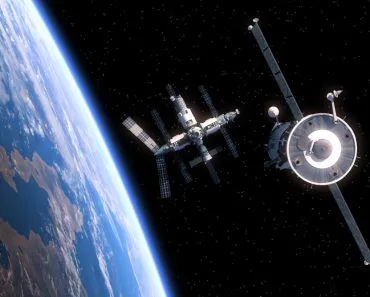
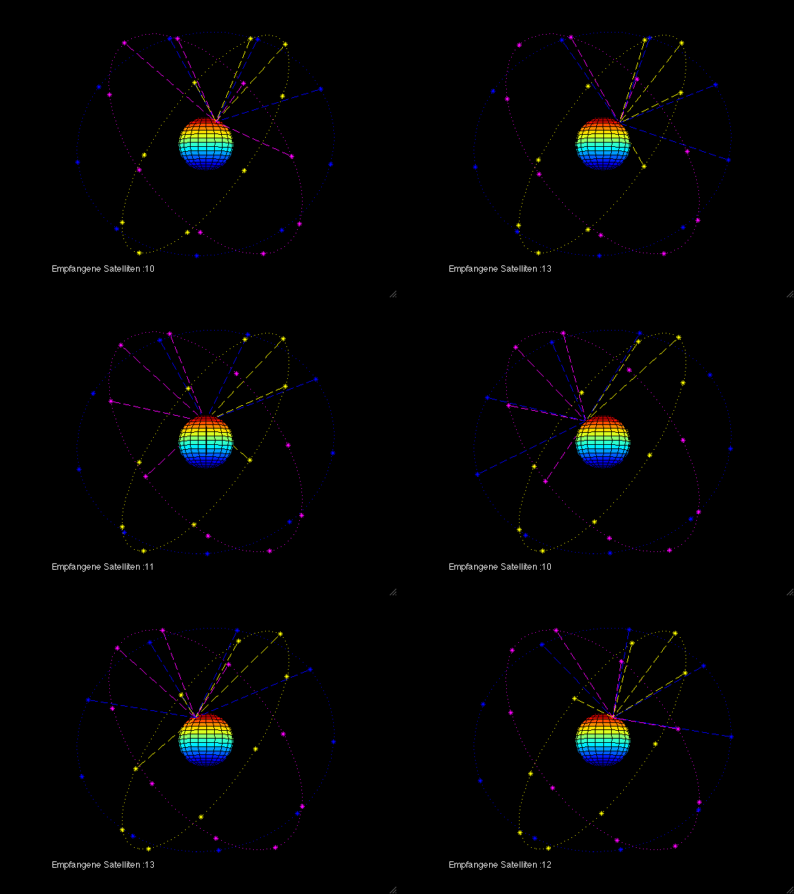
A satellite navigation system is built around a global network of satellites that broadcast radio signals down to Earth. The American system, GPS, is the one most of us rely on. The U.S. government commits to keeping at least 24 satellites operational at all times, and in practice flies around 31. They sit in six orbital planes at an altitude of roughly 20,200 km (12,550 mi), each circling the planet about twice a day. This arrangement guarantees that at least four satellites are in view from almost anywhere on the globe. GPS is not the only game in town, though. Russia runs GLONASS, the European Union operates Galileo, and China has built BeiDou. Together these networks (collectively called GNSS, for Global Navigation Satellite Systems) put well over 100 navigation satellites overhead, and most have offered free public use of their signals to the international community.
The GPS signal is broadcast with a global average user range error of 7.8 m (25.6 ft) or better, 95% of the time, and in practice modern receivers do far better than that. To pull off this arduous task, each satellite simply transmits, while your device (your smartphone, car, or a dedicated GPS unit) only listens. There is no signal sent back. Each satellite broadcasts a signal stamped with the precise moment it left the satellite. Your receiver compares that to its own clock to work out how long the signal spent in flight, then multiplies by the speed of light to get its distance from that satellite. One distance places you somewhere on a sphere around the satellite; with measurements from several satellites at once, those spheres intersect at a single point. This method is called trilateration. (It is often mislabeled "triangulation," but trilateration uses distances, not angles.) In principle three satellites are enough to pin down latitude, longitude, and altitude, but a fourth is needed to cancel out the tiny error in your receiver's own cheap quartz clock. That is why a fix needs at least four satellites in view.
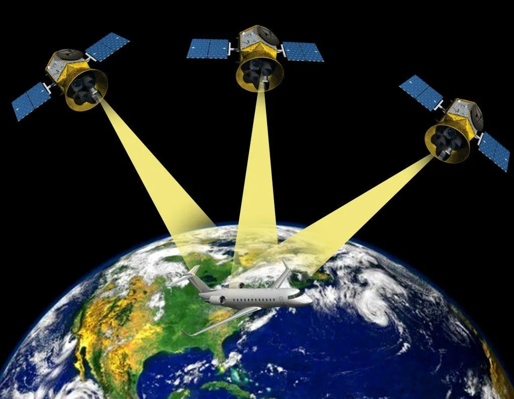
This is where those onboard atomic clocks come in, and they are incredibly accurate. The exact time is woven into the codes the satellite broadcasts, so a receiver can continuously work out the instant each signal was transmitted. This is the timestamp signal. Along with the timing, the satellite also broadcasts its own position, so the receiver knows exactly where in the sky each satellite was when it sent its message. Armed with the satellite positions and the travel times, the receiver computes its range to each one, and from those ranges it solves for its own three-dimensional position. The receiver also keeps correcting its calculations as the satellites sweep across the sky. That, in a nutshell, is the basis of how a satellite navigation system works.
Error Handling
Now, we know that any system performing work is prone to some amount of error. There are many factors that can contribute to this level of error, but we will look at some of the errors that escalate quite quickly. The first error that occurs in satellite navigation is due to the ionosphere. The ionosphere stretches from roughly 60 km to 1,000 km (about 37 to 620 mi) above sea level. The reason this region plays a significant role in potential error is that it has an appreciable number of free electrons. These free electrons have a noticeable effect on the electromagnetic waves that pass between the satellite and the receivers. The error due to the ionosphere is much less when the satellites are directly overhead than when they are near the horizon. This is because, near the horizon, the number of layers of the ionosphere increases between the satellite and the receiver.
The next errors that generally occur are errors in time. Even very small errors in time can cause major complications. A timing slip of just 1 nanosecond in the atomic clocks onboard a satellite throws the receiver off by about 30 cm (1 foot), since that is how far light travels in a nanosecond. For a global system that forms the bedrock of a lot of our technology today, such errors are not acceptable.
The next way in which time has an effect, although not in such an intuitive way, is through the infamous theories of Einstein. The special theory of relativity argues that the atomic clocks tick ever so slightly slower than the clocks that remain stationary on the ground. This is because time becomes slower as one moves faster (as speed approaches the speed of light). Even though the atomic clocks onboard the satellite travel nowhere close to the speed of light, their relative speed to the stationary clocks on Earth makes them experience time a tad bit slower than the time experienced by the clocks on Earth. Working against that is the general theory of relativity, which says that a clock deeper in a gravitational field ticks slower than one farther out. Because the satellites orbit some 20,200 km up, in weaker gravity than we feel at the surface, their clocks run faster. This gravitational effect is the larger of the two, speeding the satellite clocks up by about 45 microseconds per day. (We dig into this tug-of-war in our piece on how Einstein's relativity relates to GPS.)
Put the two together (about 45 microseconds faster from gravity, minus roughly 7 microseconds slower from speed) and each satellite clock gains close to 38 microseconds per day relative to clocks on the ground. If this were left unaccounted for, positions would drift by around 10 km (6 mi) per day, rendering the whole system useless within a couple of minutes. The fix is elegantly simple. Before launch, engineers set the clock to run slightly slow, at 10.22999999543 MHz instead of its nominal 10.23 MHz, so that once it is up in orbit relativity nudges it to tick at exactly the right rate.
So, the next time you use your GPS or GPS-dependent device, you can appreciate the amount of math and engineering that has gone into it to make life simple and reduce your chances of getting lost every time you leave your house!