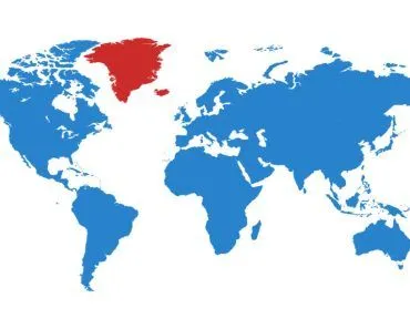
If the Strait of Gibraltar closed, the Mediterranean Sea would no longer be replenished by the Atlantic. With evaporation outpacing its rivers, it would shrink into a salty lake, then a salt-crusted swamp, and finally a desert basin far below sea level. This actually happened roughly 6 million years ago, an event known as the Messinian salinity crisis.
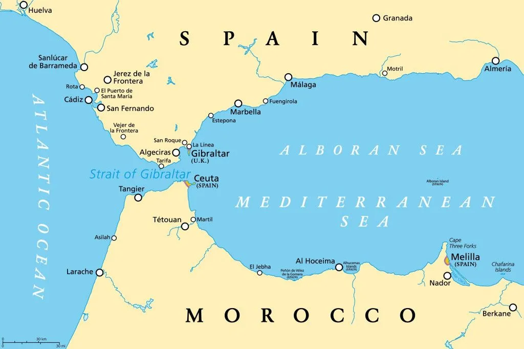
The Strait of Gibraltar is a short waterway that connects the Atlantic Ocean and the Mediterranean Sea. A strait is a narrow stretch of water that connects two seas or other large bodies of water. At its narrowest, this roughly 13-kilometer-wide (8 mi) stretch also divides Europe and Africa, with Spain and Gibraltar on one side, and Morocco on the other.
The Mediterranean Sea is almost entirely surrounded by land. The name itself comes from the Latin mediterraneus, meaning “in the middle of the land.” The narrow Strait of Gibraltar is its only connection to the rest of the seafaring globe. The Mediterranean, bordered to the south by hot, arid North African countries and to the north by sunny southern European countries, is recognized for its balmy waters and sunny beaches.
As a result of the region’s warm environment, evaporation is significantly high in the Mediterranean. Evaporation removes considerably more water than all of the largest inflowing rivers combined, including the Nile, Rhone, Po, Arno, and (through discharge from the Black Sea) the Danube. A significant circulation of water from the Atlantic Ocean also pours in via the Strait of Gibraltar, replenishing water that is lost to evaporation. The cool water from the Atlantic warms up and evaporates, which is why the sea becomes saltier as it moves eastward.
Today, the Mediterranean Sea serves as an important engine for worldwide water circulation. Evaporation adds salt to its waters, which pours back into the Atlantic Ocean and aids in driving oceanic conveyor belts that circle the globe, affecting temperature, weather patterns, and more.
Where Is The Strait Of Gibraltar, And What Does It Connect?
The Strait of Gibraltar sits at the western mouth of the Mediterranean, wedged between the southern tip of Spain (and the British territory of Gibraltar) to the north and Morocco to the south. It is the only natural opening that links the largely landlocked Mediterranean Sea to the Atlantic Ocean, and in doing so it also marks the boundary between the continents of Europe and Africa.

The waterway is short but dramatic. It runs about 58 kilometers (36 mi) from end to end and pinches to roughly 13 to 14 kilometers (8 to 9 mi) at its narrowest, between Point Marroquí in Spain and Point Cires in Morocco. In the deepest part of the narrows, its floor drops to around 900 meters (about 2,950 ft). A submarine ridge called the Camarinal Sill, only about 280 meters (920 ft) below the surface, forms the shallowest threshold across the strait and acts as a natural doorstep between the two seas.
So when people ask which bodies of water the Strait of Gibraltar joins, the answer is the Atlantic Ocean on the west and the Mediterranean Sea on the east, specifically its western arm, the Alboran Sea. It is that single narrow gap, and the water that surges back and forth across the Camarinal Sill, that keeps the Mediterranean topped up and salty rather than drying out.
Why Is The Strait Of Gibraltar So Important?
For a stretch of water you could nearly see across on a clear day, the Strait of Gibraltar carries an outsized load. Because it is the Mediterranean's only natural gateway to the Atlantic Ocean, virtually every ship sailing between the sea and the Atlantic, from oil tankers and container vessels to the ferries hopping between Europe and Africa, has to thread this single gap. That makes it one of the busiest and most strategically watched shipping chokepoints on the planet.

The strait's twin headlands have been landmarks since antiquity. The ancient Greeks and Romans knew them as the Pillars of Hercules: the Rock of Gibraltar rearing up on the European side, and a matching peak on the African shore, usually identified as Jebel Musa in Morocco (or Monte Hacho near the Spanish city of Ceuta). To classical sailors, the Pillars marked the edge of the known world, the threshold beyond which lay the open Atlantic.
Beyond trade and legend, the strait works like a planetary-scale valve. Cooler Atlantic water flows in near the surface while denser, saltier Mediterranean water slides out beneath it, a two-layer exchange that helps feed the salt and heat conveyor belts of the wider ocean. Pinch off that flow, as the rest of this article explains, and the consequences reach well beyond the coastlines of Spain and Morocco.
What If The Strait Closed?
We can predict what might happen if the strait closed, because it has happened before. Around 5.96 million years ago (give or take), the gateway sealed shut in an episode known as the great Messinian salinity crisis. Profound tectonic movements may have pushed the topography higher, cutting the important link between the Mediterranean and the Atlantic Ocean.
The Strait closed and salt water from the Atlantic Ocean ceased coming in. During such a condition of closure, the sea would transform into a deep, salty lake, then a salt-covered swamp, and eventually a desert.
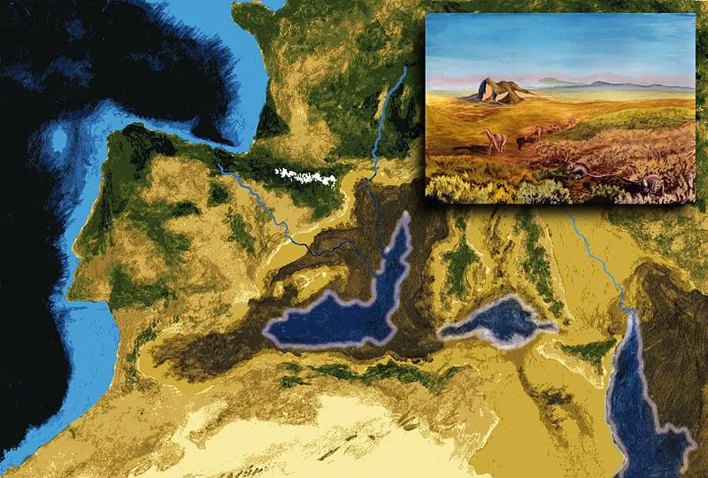
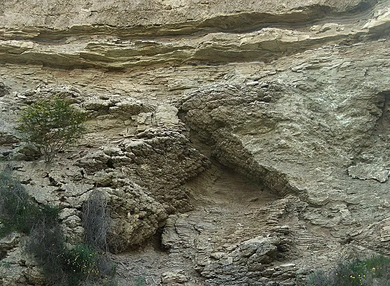
When the strait closed, in just a few thousand years, the water drained into three shallow basins in the sea’s east, west, and center. The evaporite mineral gypsum (CaSO42H2O) was deposited first in each basin, accompanied by halite (NaCl). These compounds are found in places where salty water evaporates.
A scientific research vessel’s drilling found that the ensuing evaporite salt deposits are up to 3 km (about 2 mi) deep in certain spots. This is way too much for a single evaporation cycle; the drilling data implied that the basins were flooded with saltwater numerous times before drying up and evaporating.
How Did The Mediterranean Form?
Researchers wondered why the Mediterranean basin was continuously filled with water and then later cut off. As a possibility, low-scale tectonic movements could have generated successive rises and fall in regional land levels, causing a rise and fall in the land barrier in the Strait of Gibraltar.
The most plausible theory is that sea level fluctuated due to fluctuations in the massive Antarctic ice sheet, which started forming around 14 million years ago. The Mediterranean Sea was last refilled 5.33 million years ago, at the border between the Miocene and Pliocene epochs.
A colossal flood eventually broke the barrier and rejoined the ocean with the sea. Known as the Zanclean flood, it would have been greater than Victoria, Niagara, and Iguazu Falls put together. Rather than a gentle centuries-long trickle, many researchers now think the bulk of the refilling was startlingly fast, with the basin rising by several meters a day once the breach gave way.
For decades this was largely theoretical, but in 2024 a team led by Aaron Micallef reported the first physical fingerprints of the flood on the seafloor. Mapping the Sicily Sill, the submerged ridge that once separated the western and eastern Mediterranean basins, they found more than 300 streamlined ridges carved by rushing water, plus a W-shaped channel feeding into the deep Noto Canyon, exactly the scars you would expect from one of the largest floods in Earth’s history.
Is It Possible That The Mediterranean May Dry Up Again?
Africa and Europe are both tectonically active. For millions of years, the African plate, which holds a portion of the Mediterranean seafloor, has been advancing north. It is creeping towards the Eurasian plate boundary at a rate of roughly a centimeter (about 0.4 in) every couple of years.
According to scientists who have examined the subject, it is quite likely that the Strait of Gibraltar will once again be blocked in the near geologic future.
If the Mediterranean Sea were isolated again, evaporation would force its level to drop by something on the order of a meter (a few feet) every year. Over time, this would expose well over a hundred thousand square kilometers (tens of thousands of square miles) of fresh land. That land would be agriculturally unfit, thanks to the saline sediments left behind by the salty sea. Blocking off the strait would also nudge up global sea levels, since the water evaporated from the Mediterranean would be redistributed throughout the world’s oceans.
References (click to expand)
- The Mediterranean nearly dried up. A cataclysmic flood .... National Geographic
- Lelieveld, J., Hadjinicolaou, P., Kostopoulou, E., Chenoweth, J., El Maayar, M., Giannakopoulos, C., … Xoplaki, E. (2012, March 7). Climate change and impacts in the Eastern Mediterranean and the Middle East. Climatic Change. Springer Science and Business Media LLC.
- 15. Strait of Gibraltar, Atlantic Ocean/Mediterranean Sea. Lunar and Planetary Institute
- Skinner B. J.,& Murck B. W. (2010). The Blue Planet: An Introduction to Earth System Science, 3rd Edition: An Introduction to Earth System Science. Wiley Global Education
- Micallef, A., et al. (2024). Land-to-sea indicators of the Zanclean megaflood. Communications Earth & Environment. Nature Publishing Group.
- Strait of Gibraltar. Encyclopaedia Britannica
- Camarinal Sill. Wikipedia
- Pillars of Heracles. Encyclopaedia Britannica