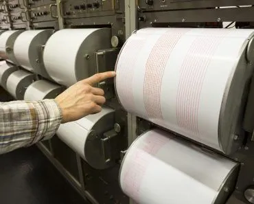
Paleomagnetism is the study of Earth’s magnetic history through the ancient magnetic record locked in rocks. As iron-rich lava cools, it freezes a snapshot of the magnetic field, recording reversals of the poles. Symmetrical magnetic stripes on the seafloor became key evidence for seafloor spreading and plate tectonics.
During WWII, highly sensitive magnetometers were created to detect enemy submarines. Later, geologists updated these devices and trailed them behind research vessels to measure the local magnetic fields created by magnetized rocks on the seabed.
Scientists were amazed when they detected repeated patterns in the strength of the nearby magnetic field.
The magnetic field lines were nearly symmetrical around the top of mid-ocean ridges. The discovery of these structures was a breakthrough that verified the theory of seafloor spreading and inspired the idea of plate tectonics. It even enabled scientists to trace plate movements in geological history.
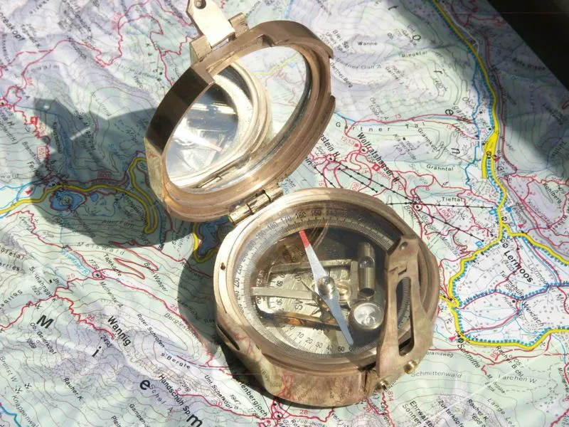
If we suspend a compass needle freely, the needle’s alignment would shift continually from one point to another. Additionally, if we measure the force on the magnetic needle that causes it to take its preferred alignment, we would discover that the intensity of this force, which depends on the intensity of the magnetic field, fluctuates constantly with its position in space.
This is the idea behind paleomagnetism. It is the investigation of the history of Earth’s magnetic field using the magnetic fields preserved in rocks.
The Geodynamo
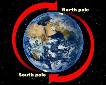
The geodynamo theory suggests a method by which the Earth creates its magnetic field. According to scientists, heat escaping from the solid inner core drives convection in the molten iron of the liquid outer core. Convection is the process of transferring heat through the movement of hot fluids. As the Earth spins, the rotation organizes this churning iron into swirling patterns, and the motion of the electrically conducting metal generates and sustains the magnetic field.
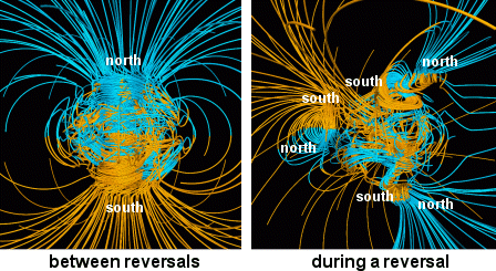
Imagine how surprised scientists must have been half a century ago when they discovered geological evidence of the reversal of direction of the magnetic field. These magnetic reversals happen in unpredictable periods. The reasons are not fully understood, although computer simulations of the geodynamo show rare reversals happening in the absence of external forces, implying that they are caused solely by interactions within Earth’s core. The period between reversals has varied greatly, averaging on the order of a few hundred thousand years, with the most recent full reversal (the Brunhes-Matuyama reversal) occurring about 780,000 years ago.
The Rock Record Of Magnetic Reversals
Magnetic anomalies show that the Earth’s magnetic field is not consistent throughout time. Geologists discovered around the 1960s that stratified layers of volcanic lava can provide a detailed record of this unusual behavior. As lavas rich in iron oxides cool, they pass through a threshold called the Curie point (about 580 °C, or 1,076 °F, for magnetite). Above this temperature the minerals hold no permanent magnetism, but as the rock cools below it, its magnetic grains lock into alignment with the Earth’s magnetic field at that moment. The cooled lava effectively “remembers” that direction, even after the field has shifted, so this frozen-in record is known as thermoremanent magnetization.
Paleomagnetism As Evidence For Seafloor Spreading
Scientists were perplexed by the banded formations of magnetism seen on the seafloor until 1963, when two researchers, F. J. Vine and D. H. Matthews, and, independently, L. Morley and A. Larochelle, presented a stunning proposal. They reasoned that the magnetic intensity patterns on the seabed linked to areas of rock magnetized during previous regular and reversed magnetism episodes.
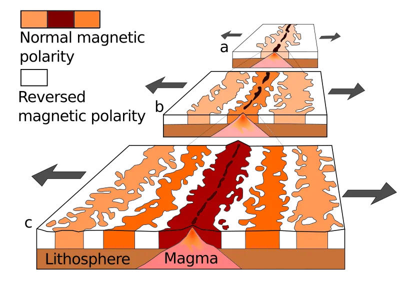
As the tectonic plates separate at the mid-ocean ridge, lava gushes from the Earth’s core and streams into the fissure, where it cools, hardens, and magnetizes in the direction of the Earth’s magnetic field at that time. When the seafloor moves away from the ridge, about half of the newly magnetic material flows to one side and half flows to the other, resulting in two symmetrical magnetized bands. Younger material covers the empty space, allowing the process to continue. In this respect, the seafloor serves as a magnetic recorder, collecting the archive of the evolution of the ocean.
How Do Magnetic Stripes Reveal The Age Of The Seafloor?
The stripes are not just proof that the seafloor spreads. They are also a clock. To read it, geologists first needed an independent calendar of when the magnetic field flipped. In the 1960s, a team at the U.S. Geological Survey, the geophysicists Allan Cox and Richard Doell together with isotope geochemist Brent Dalrymple, built that calendar. They collected volcanic rocks from around the world, measured the magnetic direction frozen into each one, and then dated the same rocks using the radioactive decay of potassium into argon. Because the potassium-40 isotope has a half-life of about 1,310 million years, it works as a steady atomic timer for rocks millions of years old. Pairing each magnetic direction with an isotopic age produced the Geomagnetic Polarity Time Scale, a master list of normal and reversed intervals stretching back through geological time.
With that calendar in hand, the seafloor stripes suddenly made sense. The pattern of wide and narrow bands beside a ridge matches the pattern of long and short polarity intervals on the time scale, like a barcode. By lining up a measured stripe with its entry on the time scale, scientists can read off the age of the rock directly. The spacing between matching stripes on either side then gives the spreading rate: knowing that a band formed during a reversal of a known age, and measuring how far it now sits from the ridge, yields a speed of a few centimeters per year (roughly the rate your fingernails grow). Using this method, researchers have dated nearly all of the ocean floor, the oldest parts of which are about 180 million years old. Crucially, the rock is youngest at the ridge crest and grows steadily older with distance from it, exactly what a spreading seafloor demands. This was a major piece of the puzzle that turned Wegener's once-dismissed idea of continental drift into the modern theory of plate tectonics.
How Do Scientists Read The Magnetism Locked In Rocks?
Towing a magnetometer behind a ship reveals the broad striping pattern, but to pin down a precise direction and age, geologists need the rock itself. They collect oriented samples: a small core is drilled out, and before it is removed its position is recorded with a magnetic compass (and often a sun compass too), so the rock's original alignment is preserved once it reaches the lab. For the ocean floor, that meant going out and physically drilling into it.

The decisive test came from the Glomar Challenger, the drilling ship of the Deep Sea Drilling Project. In 1968 it crisscrossed the Mid-Atlantic Ridge between South America and Africa, pulling up sediment and rock cores at many locations. When those samples were dated by both fossil content and isotopic methods, they confirmed that the seafloor really does get progressively older away from the ridge, the clinching evidence for seafloor spreading.
Back in the laboratory, the cores are measured in a sensitive instrument such as a spinner magnetometer, housed in a magnetically shielded space that screens out the modern field. By carefully stripping away later magnetic overprints, scientists isolate the original magnetization, the faint signal the rock locked in as it first cooled, and so recover both the direction of the ancient field and, through dating, when that snapshot was taken.
Polar Wandering
Apparent Polar Wandering (APW) is a method of showing magnetic pole location. It assumes the continent stayed in a stable place and registers a chart tracing the location of magnetic poles at different times. Paleomagnetic investigations revealed that the APW trajectories differed between continents. Hence, the APW not only showed that continental drift did indeed happen, but it also gave a technique for estimating the movement. APW routes have been utilized to understand movements, collisions, and continental breakups.
Conclusion
Geologists employed paleomagnetism in conjunction with isotope dating techniques to determine the timeline of magnetic reversals during the past 170 million years. This information is utilized to date fresh rock formations. Paleomagnetic stratigraphy is valuable to archaeologists, anthropologists, and geologists alike. It is a valuable tool in the study of earth sciences and provides the basis for many fundamental theories.
References (click to expand)
- Grotzinger J.,& Jordan T. H. (2014). Understanding Earth: Seventh Edition. Macmillan Learning
- Flip Flop: Why Variations in Earth's Magnetic Field Aren't Causing Today's Climate Change. NASA Science.
- Is it true that Earth's magnetic field occasionally reverses its polarity? U.S. Geological Survey.
- How does the Earth's core generate a magnetic field? U.S. Geological Survey.
- Thermoremanent magnetism. Encyclopaedia Britannica.
- Paleomagnetism. Michigan Technological University.
- Magnetic stripes and isotopic clocks. This Dynamic Earth, U.S. Geological Survey.
- Developing the theory. This Dynamic Earth, U.S. Geological Survey.
- Seafloor Spreading. National Geographic Education.